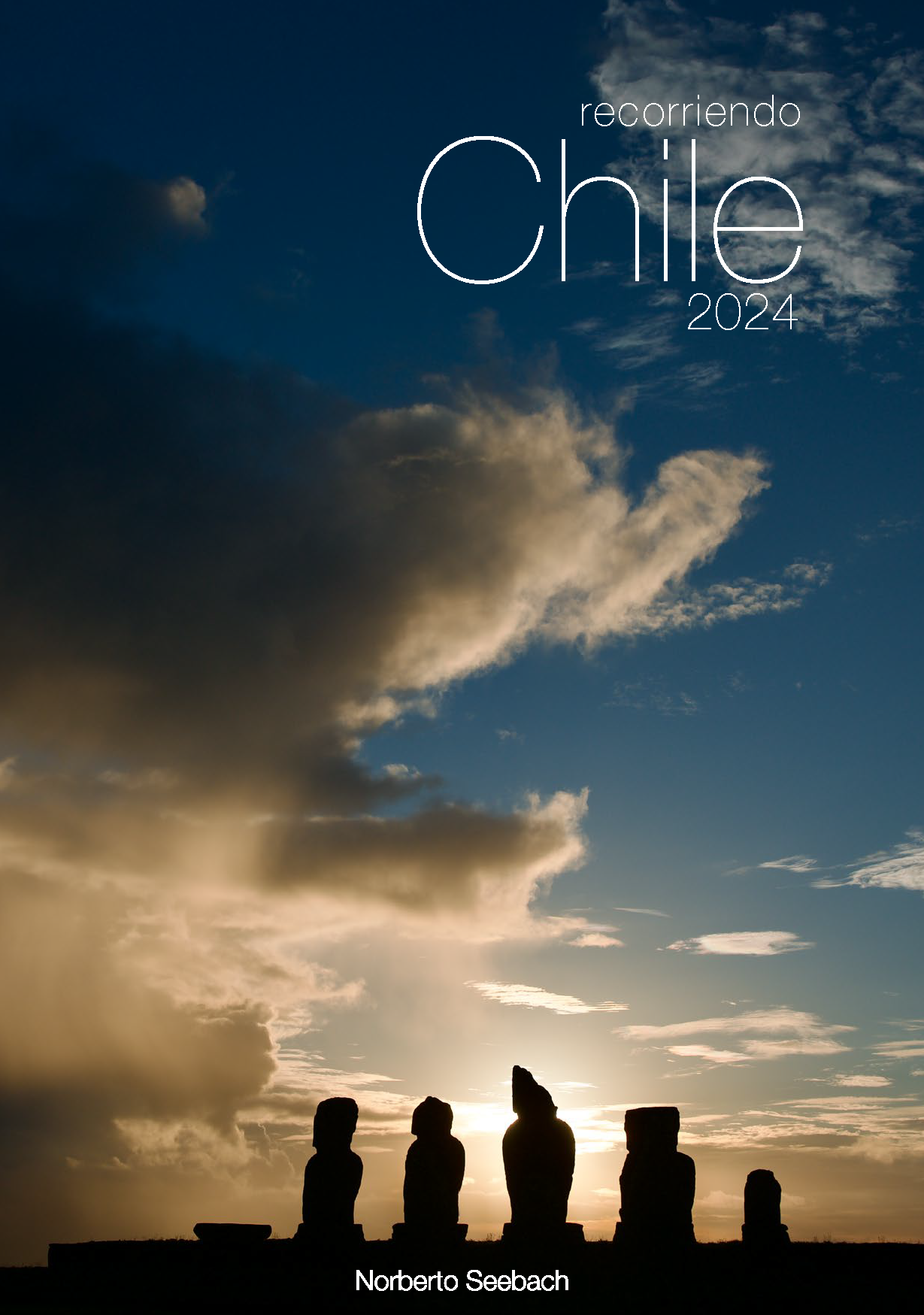
Recorriendo Chile
Resumen del pedido
Tu carro está vacío.
Productos
0
$0
Envío
$0
Total
$0
Calendario 2024
PORTADA
Ahu Tahai
Rapa Nui, Región de Valparaíso
Con frecuencia se afirma que la misteriosa isla de Rapa Nui es tal vez la más aislada del mundo. Se encuentra a 3800 km de Santiago, lo que equivale a la distancia que separa a las ciudades extremas de Chile: Arica y Punta Arenas. Los moái, enormes estatuas labradas en lava volcánica que decoran la isla, con frecuencia se reúnen en ahus o plataformas ceremoniales. El ahu Tahai es seguramente el más fotografiado de Rapa Nui dado que es el más cercano al poblado de Hanga Roa, y además constituye casi un ceremonial para los turistas compartir y disfrutar los coloridos atardeceres con un sol que se sumerge en el Pacífico.
It is often claimed that the mysterious Easter Island, also known as Rapa Nui, is perhaps the most isolated island in the world. It is located 3800 km from Santiago, which is equivalent to the distance between the extreme cities of Chile: Arica and Punta Arenas. The moai, enormous statues carved from volcanic lava that adorn the island, are often found gathered on ahus or ceremonial platforms. The Ahu Tahai is likely the most photographed on Rapa Nui, as it is the closest to the village of Hanga Roa, and it offers tourists the opportunity to share and enjoy colorful sunsets as the sun sinks into the Pacific.
Es wird oft behauptet, dass die geheimnisvolle Osterinsel, auch Rapa Nui genannt, vielleicht das isolierteste Eiland der Welt ist. Die Entfernung zwischen Santiago und Rapa Nui beträgt 3800 km, was dem Abstand zwischen den nördlichsten und südlichsten Städten Chiles, Arica und Punta Arenas, entspricht. Die Moai, riesige Statuen, die aus vulkanischem Lavagestein gehauen sind, befinden sich oft auf ahus oder zeremoniellen Plattformen versammelt. Der Ahu Tahai ist wahrscheinlich der meistfotografierte da er am nächsten zum Dorf Hanga Roa liegt und Touristen die Möglichkeit bietet, farbenfrohe Sonnenuntergänge zu genießen.
ENERO
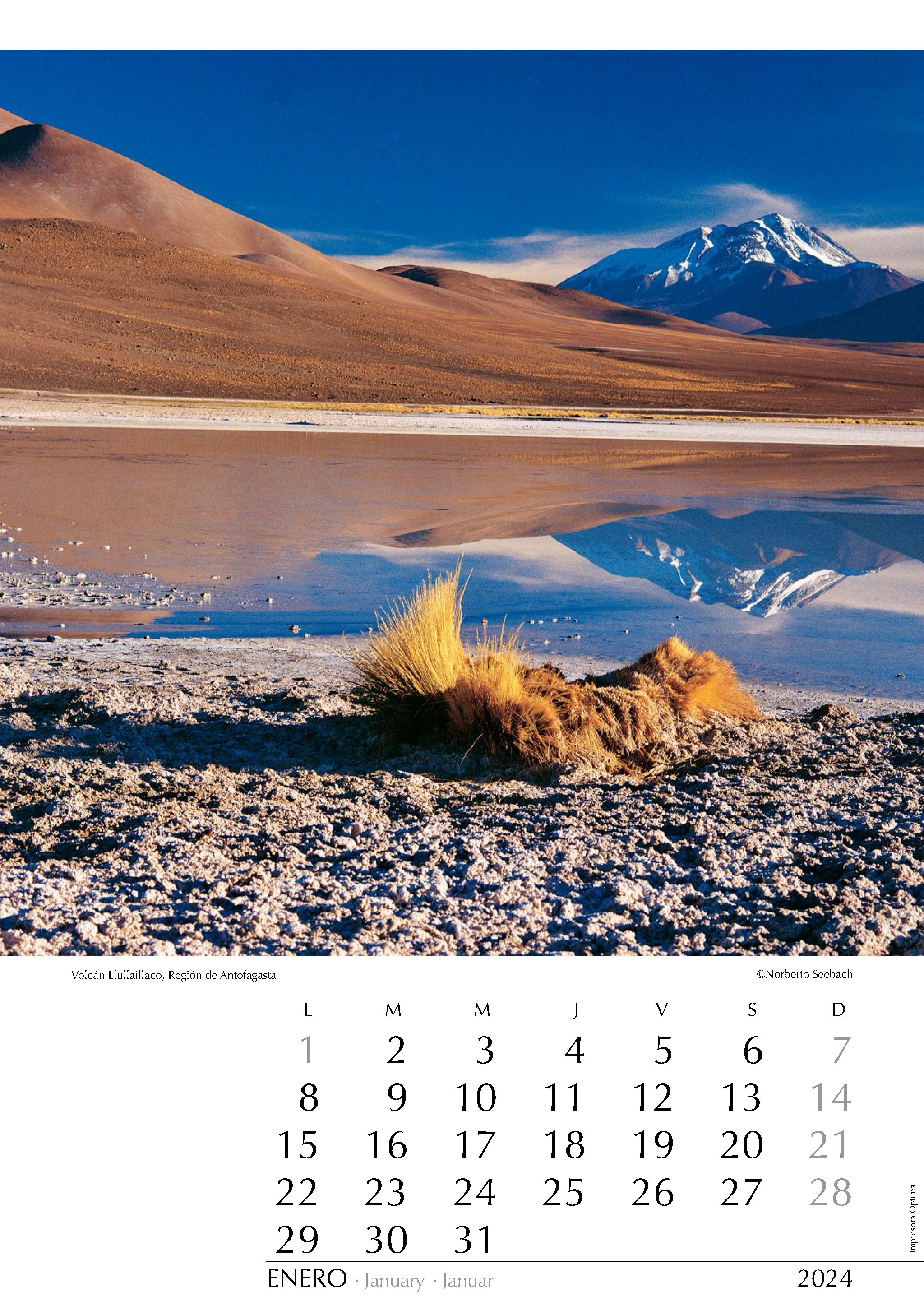
Volcán Llullaillaco
Región de Antofagasta
El volcán Llullaillaco (6740 m) es la segunda cumbre más alta de Chile y está ubicado en la frontera con Argentina a unos 120 km al sur del Salar de Atacama, junto al paso Socompa. El volcán fue centro de rituales y ceremonias de pueblos originarios. En las cercanías de la cumbre fueron halladas las Momias de Llullaillaco, las tumbas ceremoniales de tres cuerpos infantiles momificados hace unos 500 años. Las momias se exhiben, no exentas de polémica, de manera rotativa en el Museo de Arqueología de Alta Montaña de Salta, Argentina.
The Llullaillaco volcano (6740 m) is the second highest summit in Chile and is located on the border with Argentina, about 120 km south of the Salar de Atacama, near the Socompa Pass. The volcano was a center of rituals and ceremonies for indigenous peoples. Near the summit, the Llullaillaco Mummies were discovered, ceremonial tombs containing the mummified remains of three children from around 500 years ago. The mummies are exhibited, not without controversy, in a rotating manner at the Museum of High Mountain Archaeology in Salta, Argentina.
Der Llullaillaco-Vulkan (6740 m) ist der zweithöchste Gipfel in Chile und liegt an der Grenze zu Argentinien, etwa 120 km südlich des Salar de Atacama, in der Nähe des Socompa-Passes. Der Vulkan war ein Zentrum für Rituale und Zeremonien der indigenen Völker. In der Nähe des Gipfels wurden die Llullaillaco-Mumien entdeckt, zeremonielle Gräber mit den mumifizierten Überresten von drei Kindern, die vor etwa 500 Jahren gelebt haben. Die Mumien werden abwechselnd -nicht ohne Kontroversen- im Museum für Hochgebirgsarchäologie in Salta, Argentinien, ausgestellt.
FEBRERO
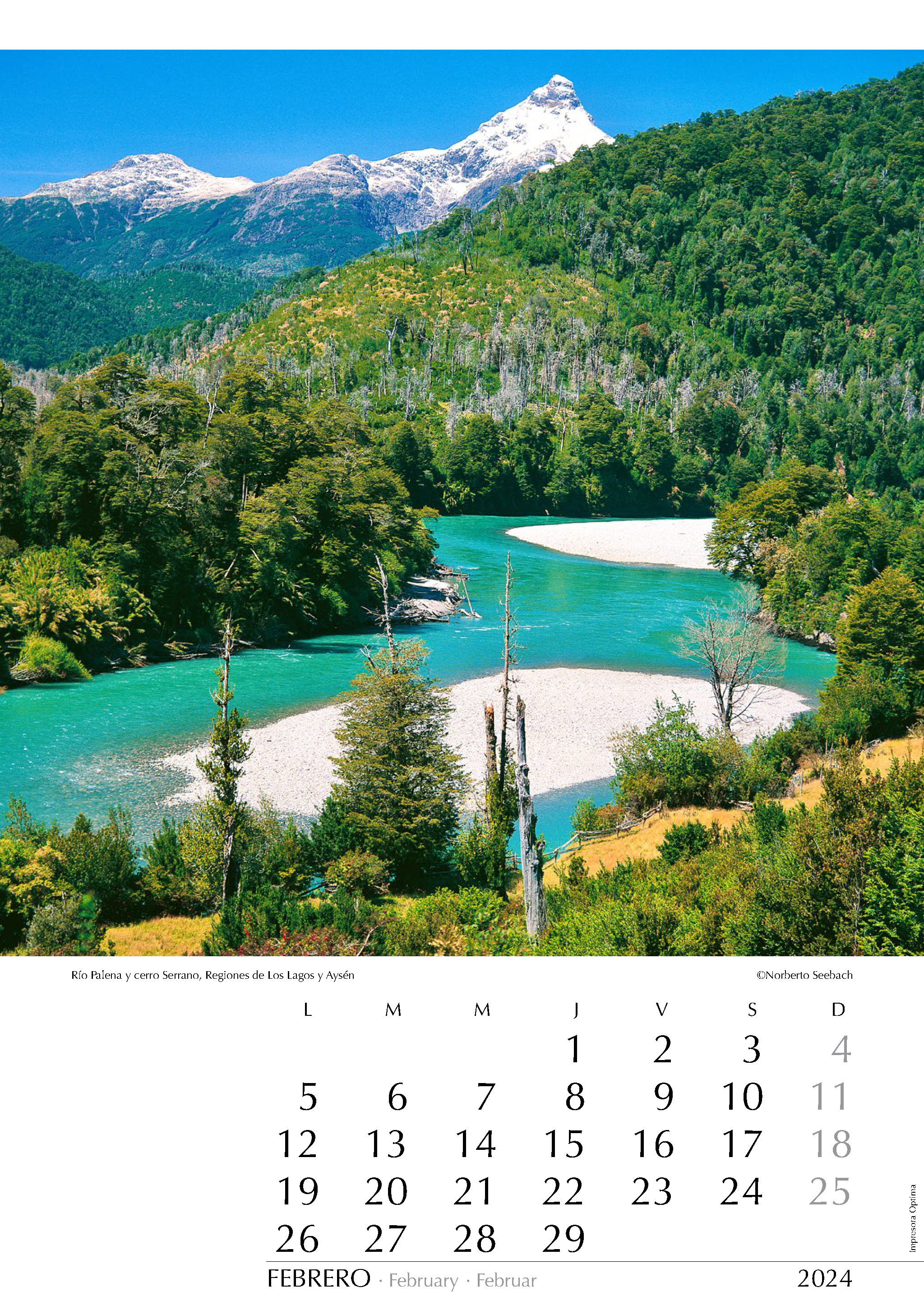
Río Palena y cerro Serrano
Regiones de Los Lagos y Aysén
Entre las cordilleras patagónicas se encuentran una serie de lagos compartidos por Chile y Argentina. El lago Palena (llamado General Vintter o General Paz en Argentina) es desaguado en el lado argentino por el Río Corcovado hacia el oriente, luego gira al norte y finalmente al poniente, cruzando la frontera, donde cambia su nombre a Palena, hasta la confluencia con el río Frío que fluye desde el norte. Juntos corren hacia el sur por un amplio valle que se aprovechó para el trazado de la Carretera Austral. La vista corresponde al curso medio del Palena justo en el límite de las Regiones de los Lagos y Aysén.
Among the Patagonian mountain ranges, there is a series of lakes shared by Chile and Argentina. Lake Palena (called General Vintter or General Paz in Argentina) drains in Argentina through the Corcovado River to the east, then turns north and west, crossing the border, where it changes its name to Palena, until it meets the Frío River flowing from the north. Together, they run south through a wide valley that was used for the construction of the Carretera Austral. The view corresponds to the middle course of the Palena River, right on the border between the Los Lagos and Aysén regions.
Zwischen den patagonischen Gebirgsketten liegen eine Reihe von Seen, die von Chile und Argentinien geteilt werden. Der Palena-See (in Argentinien General Vintter oder General Paz genannt) entwässert in Argentinien durch den Fluss Corcovado nach Osten, dreht dann nach Norden und Westen ab, überquert die Grenze und ändert dort seinen Namen in Palena, bis er auf den aus dem Norden kommenden Fluss Frío trifft. Gemeinsam fließen sie durch ein weites Tal nach Süden, das für den Bau der Carretera Austral genutzt wurde. Das Bild entspricht dem mittleren Lauf des Palena-Flusses, an der Grenze zwischen den Regionen Los Lagos und Aysén.
MARZO
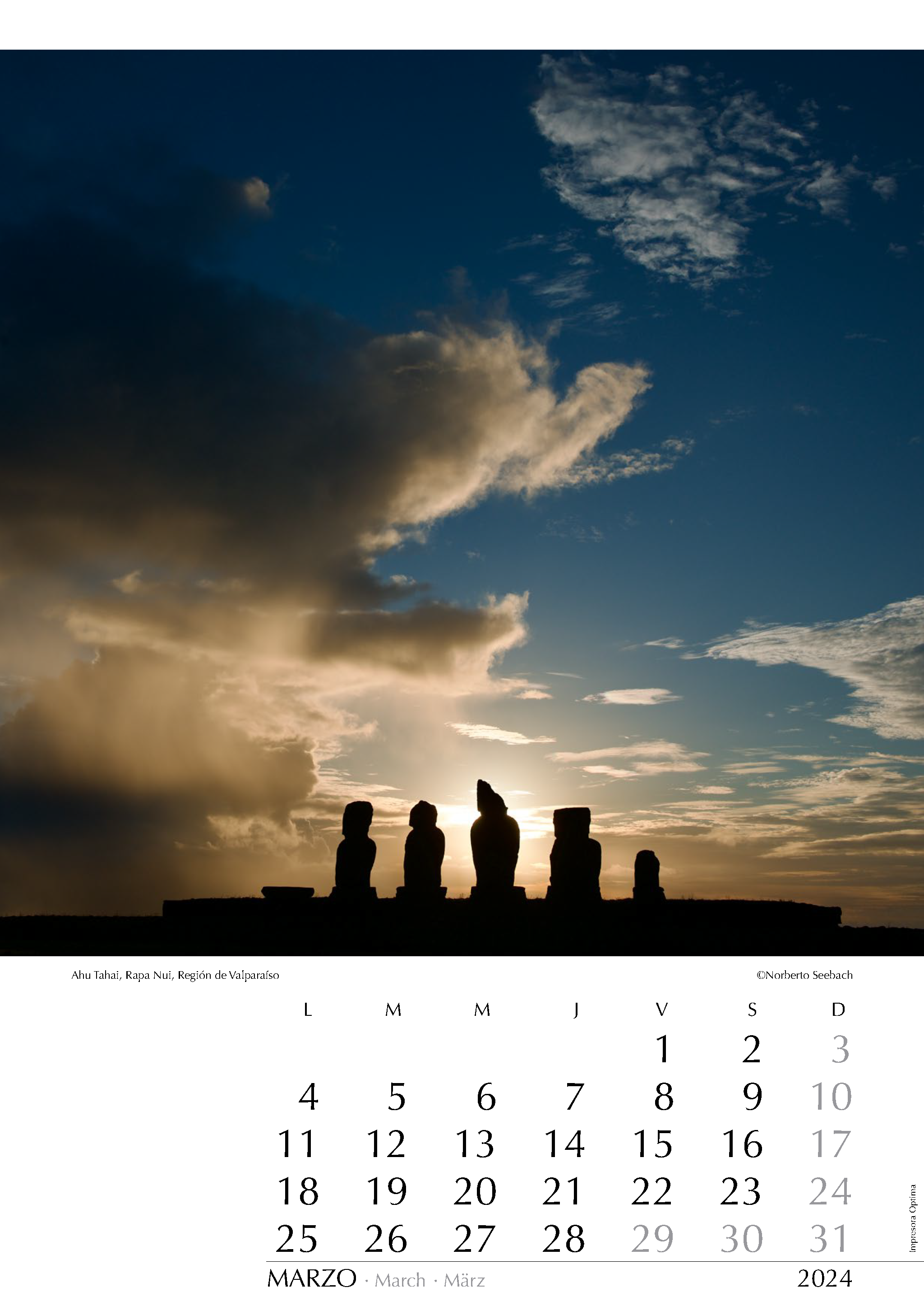
Ahu Tahai
Rapa Nui, Región de Valparaíso
Con frecuencia se afirma que la misteriosa isla de Rapa Nui es tal vez la más aislada del mundo. Se encuentra a 3800 km de Santiago, lo que equivale a la distancia que separa a las ciudades extremas de Chile: Arica y Punta Arenas. Los moái, enormes estatuas labradas en lava volcánica que decoran la isla, con frecuencia se reúnen en ahus o plataformas ceremoniales. El ahu Tahai es seguramente el más fotografiado de Rapa Nui dado que es el más cercano al poblado de Hanga Roa, y además constituye casi un ceremonial para los turistas compartir y disfrutar los coloridos atardeceres con un sol que se sumerge en el Pacífico.
It is often claimed that the mysterious Easter Island, also known as Rapa Nui, is perhaps the most isolated island in the world. It is located 3800 km from Santiago, which is equivalent to the distance between the extreme cities of Chile: Arica and Punta Arenas. The moai, enormous statues carved from volcanic lava that adorn the island, are often found gathered on ahus or ceremonial platforms. The Ahu Tahai is likely the most photographed on Rapa Nui, as it is the closest to the village of Hanga Roa, and it offers tourists the opportunity to share and enjoy colorful sunsets as the sun sinks into the Pacific.
Es wird oft behauptet, dass die geheimnisvolle Osterinsel, auch Rapa Nui genannt, vielleicht das isolierteste Eiland der Welt ist. Die Entfernung zwischen Santiago und Rapa Nui beträgt 3800 km, was dem Abstand zwischen den nördlichsten und südlichsten Städten Chiles, Arica und Punta Arenas, entspricht. Die Moai, riesige Statuen, die aus vulkanischem Lavagestein gehauen sind, befinden sich oft auf ahus oder zeremoniellen Plattformen versammelt. Der Ahu Tahai ist wahrscheinlich der meistfotografierte da er am nächsten zum Dorf Hanga Roa liegt und Touristen die Möglichkeit bietet, farbenfrohe Sonnenuntergänge zu genießen.
Con frecuencia se afirma que la misteriosa isla de Rapa Nui es tal vez la más aislada del mundo. Se encuentra a 3800 km de Santiago, lo que equivale a la distancia que separa a las ciudades extremas de Chile: Arica y Punta Arenas. Los moái, enormes estatuas labradas en lava volcánica que decoran la isla, con frecuencia se reúnen en ahus o plataformas ceremoniales. El ahu Tahai es seguramente el más fotografiado de Rapa Nui dado que es el más cercano al poblado de Hanga Roa, y además constituye casi un ceremonial para los turistas compartir y disfrutar los coloridos atardeceres con un sol que se sumerge en el Pacífico.
It is often claimed that the mysterious Easter Island, also known as Rapa Nui, is perhaps the most isolated island in the world. It is located 3800 km from Santiago, which is equivalent to the distance between the extreme cities of Chile: Arica and Punta Arenas. The moai, enormous statues carved from volcanic lava that adorn the island, are often found gathered on ahus or ceremonial platforms. The Ahu Tahai is likely the most photographed on Rapa Nui, as it is the closest to the village of Hanga Roa, and it offers tourists the opportunity to share and enjoy colorful sunsets as the sun sinks into the Pacific.
Es wird oft behauptet, dass die geheimnisvolle Osterinsel, auch Rapa Nui genannt, vielleicht das isolierteste Eiland der Welt ist. Die Entfernung zwischen Santiago und Rapa Nui beträgt 3800 km, was dem Abstand zwischen den nördlichsten und südlichsten Städten Chiles, Arica und Punta Arenas, entspricht. Die Moai, riesige Statuen, die aus vulkanischem Lavagestein gehauen sind, befinden sich oft auf ahus oder zeremoniellen Plattformen versammelt. Der Ahu Tahai ist wahrscheinlich der meistfotografierte da er am nächsten zum Dorf Hanga Roa liegt und Touristen die Möglichkeit bietet, farbenfrohe Sonnenuntergänge zu genießen.
ABRIL
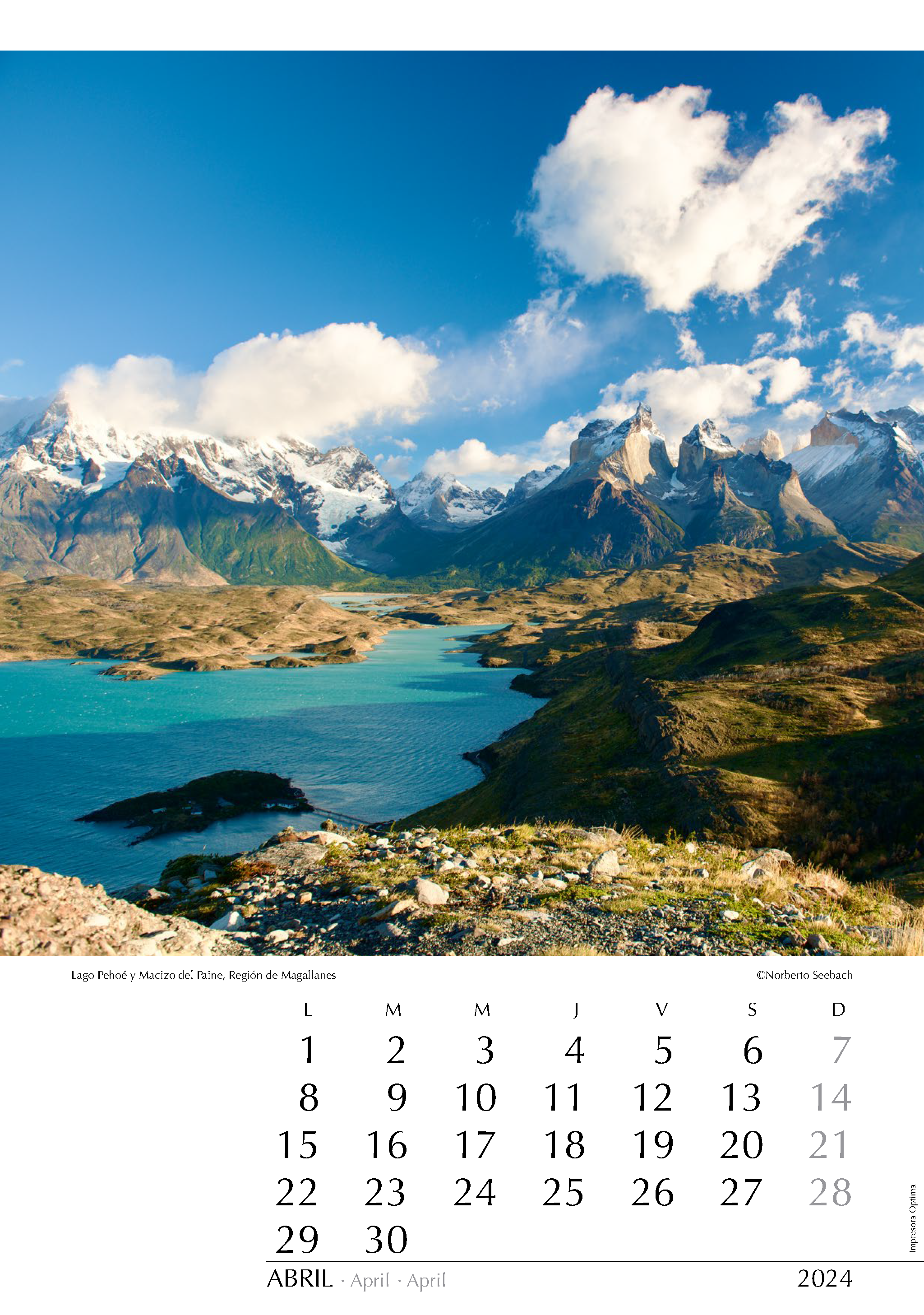
Lago Pehoé y Macizo del Paine
Región de Magallanes
Las cumbres del macizo que coronan los 2400 km2 del Parque Nacional Torres del Paine son un ícono entre las bellezas escénicas de la Patagonia. La “majestuosa montaña” ensalzada en el Himno Nacional se muestra en todo su esplendor durante un amanecer otoñal. Se aprecia el lago Pehoe en primer plano y el lago Nordenskjöld más atrás. Como telón de fondo, a la izquierda y entre las nubes, se encuentran la Punta Bariloche (2600 m) y el cerro Paine Grande (3050 m). En el centro se extiende el Valle Francés; y a la derecha, se yerguen los Cuernos (2600 m y 2200 m) y el Cerro Almirante Nieto (2640 m).
The peaks of the mountain range that crown the 2400 km2 Torres del Paine National Park are an icon among the scenic beauties of Patagonia. The “Majestuosa Montaña” exalted in the National Anthem reveals its full splendor during an autumn sunrise. Lake Pehoe is visible in the foreground, with Lake Nordenskjöld further back. As a backdrop, on the left and amidst the clouds, are Punta Bariloche (2600 m) and the Paine Grande (3050 m). In the center, the Valle Francés extends, and to the right, the Cuernos (2600 m and 2200 m) and Cerro Almirante Nieto (2640 m) stand tall.
Die Gipfel des Bergmassivs, die die 2400 km2 des Torres-del-Paine-Nationalparks krönen, sind ein Wahrzeichen Patagoniens. Die „Majestuosa Montaña”, die in der Nationalhymne geehrt wird, zeigt sich in seiner ganzen Pracht während eines herbstlichen Sonnenaufgangs. Im Vordergrund ist der Pehoe-See zu sehen, dahinter der Nordenskjöld-See. Als Kulisse, links und zwischen den Wolken, erheben sich Punta Bariloche (2600 m) und der Paine Grande (3050 m). In der Mitte erstreckt sich das Tal des Valle Francés, und rechts ragen die Cuernos (2600 m und 2200 m) sowie der Cerro Almirante Nieto (2640 m) majestätisch empor.
MAYO
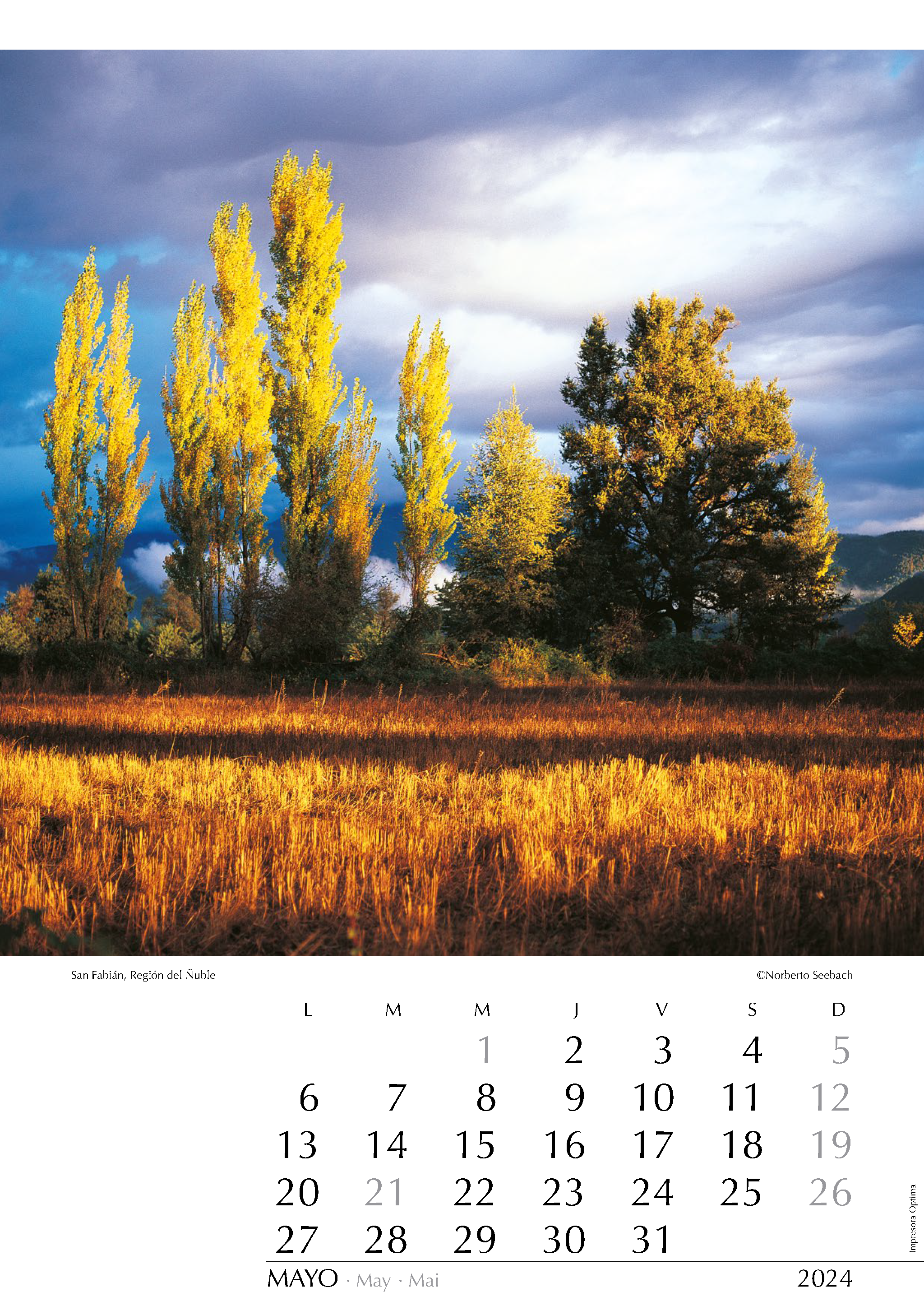
San Fabián
Región del Ñuble
Los álamos son una especie arbórea originaria del hemisferio norte pero que ha sido introducida en diversas partes de Sudamérica desde tiempos inmemorables. En Chile se ha adaptado notablemente y forma parte esencial del campo chileno. Es habitual verlos en las más diversas latitudes: en los valles transversales del Norte Chico, en los campos de la zona central e incluso en la Patagonia. Están presentes en prácticamente todo el país. En San Fabián, a orillas del río Ñuble, los últimos rayos de un atardecer de otoño iluminan los potreros.
Poplars are a tree species native to the northern hemisphere but have been introduced to various parts of South America since time immemorial. In Chile, they have adapted remarkably and are an essential part of the Chilean countryside. It is common to see them in diverse latitudes: in the transversal valleys of the Norte Chico, in the farms of Central Chile, and even in Patagonia. They are present throughout the country. In San Fabián, along the banks of the Ñuble River, the last rays of an autumn sunset illuminate the pastures.
Pappeln sind eine Baumart, die ursprünglich aus der nördlichen Erdhalbkugel stammt, aber seit undenklichen Zeiten in verschiedene Teile Südamerikas eingeführt wurde. In Chile haben sie sich bemerkenswert gut angepasst und sind ein wesentlicher Bestandteil der chilenischen Landschaft. Man kann sie sehr häufig in den verschiedensten Breitengraden antreffen: in den Quertälern des Norte Chico, auf den Landgütern in Zentralchile und sogar in Patagonien. Sie sind im ganzen Land verbreitet. In San Fabián, am Ufer des Río Ñuble, erhellen die letzten Strahlen eines herbstlichen Sonnenuntergangs die Weiden.
JUNIO
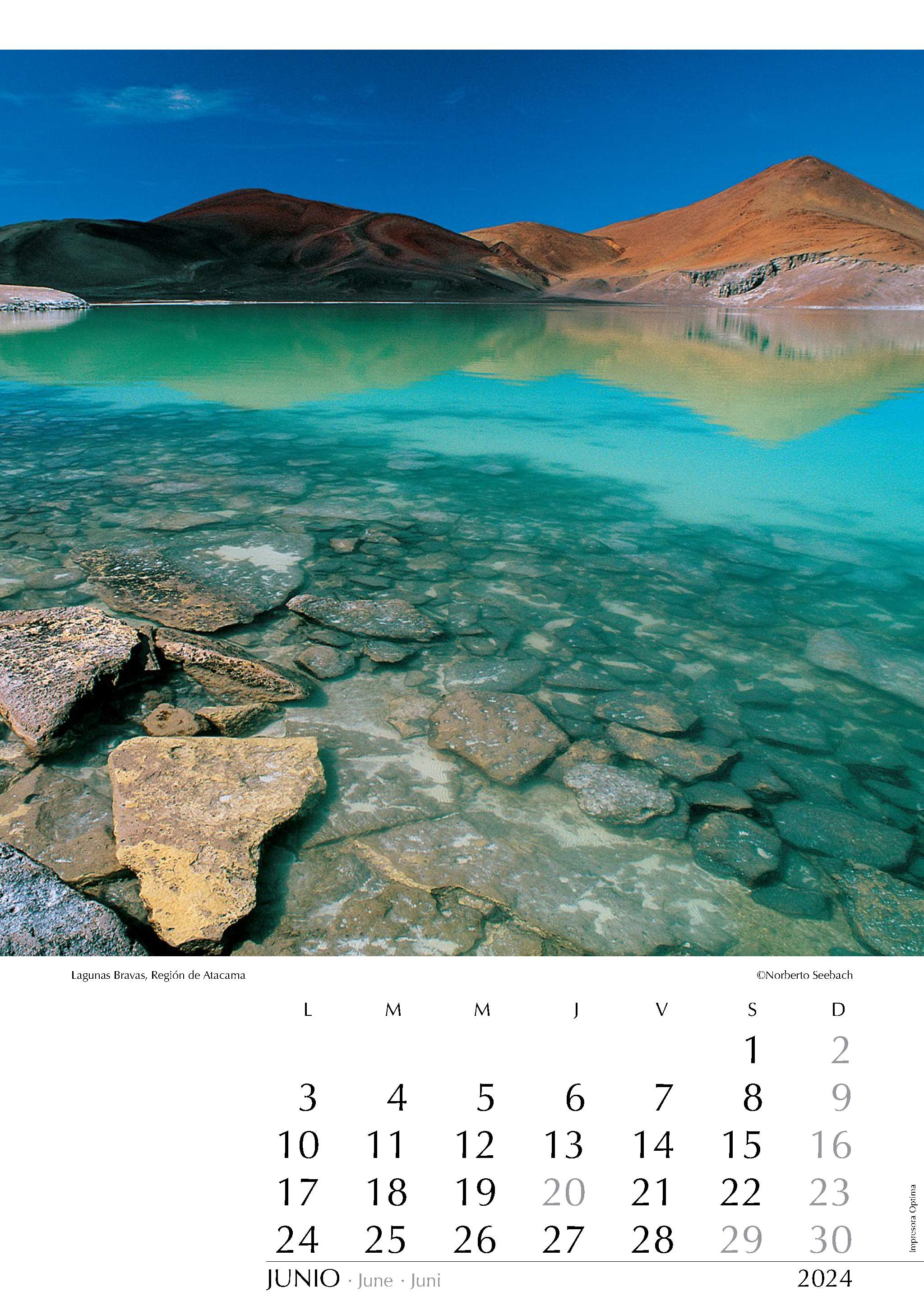
Lagunas Bravas
Región de Atacama
La vastedad del desierto de Atacama presenta zonas cuya soledad y aislamiento impactan. Por sobre los 4000 m de altitud, a más de 200 km al noreste de Copiapó y junto a la frontera con Argentina, la irregular topografía andina incluye lagunas y salares de increíbles colores que se extienden a los pies de elevadas cumbres generalmente volcánicas. Tal es el caso de las lagunas Bravas que aquí se muestran en un atardecer de verano. Acceder hasta aquí sólo es posible tras recorrer precarias huellas que se apartan de la ruta Maricunga - El Salvador.
The vastness of the Atacama Desert presents areas whose solitude and isolation leave a profound impact. Above 4000 meters in altitude, over 200 kilometers northeast of Copiapó and near the border with Argentina, the irregular Andean topography includes lagoons and salt flats of incredible colors that extend at the base of towering peaks, mainly volcanic in nature. Such is the case of the Lagunas Bravas shown here during a sunset in summer. Access to this area is only possible after following precarious trails that deviate from the Maricunga - El Salvador route.
Die Weite der Atacama-Wüste birgt Gegenden von beeindruckender Einsamkeit und Verlassenheit. Auf über 4000 m ü.d.M. und mehr als 200 km nordöstlich von Copiapó stößt man in der von Gebirgsketten durchzogenen Landschaft auf unglaublich gefärbte Lagunen und Salzseen. Am Fuße hoher Andengipfel, meist vulkanischen Ursprungs, befinden sich die Lagunas Bravas, die hier bei einem Sonnenuntergang im Sommer gezeigt werden. Nur wenn man abenteuerliche Spuren, die von der Straße Maricunga - El Salvador abgehen folgt, kann man diese entlegenen Landstriche erreichen.
JULIO
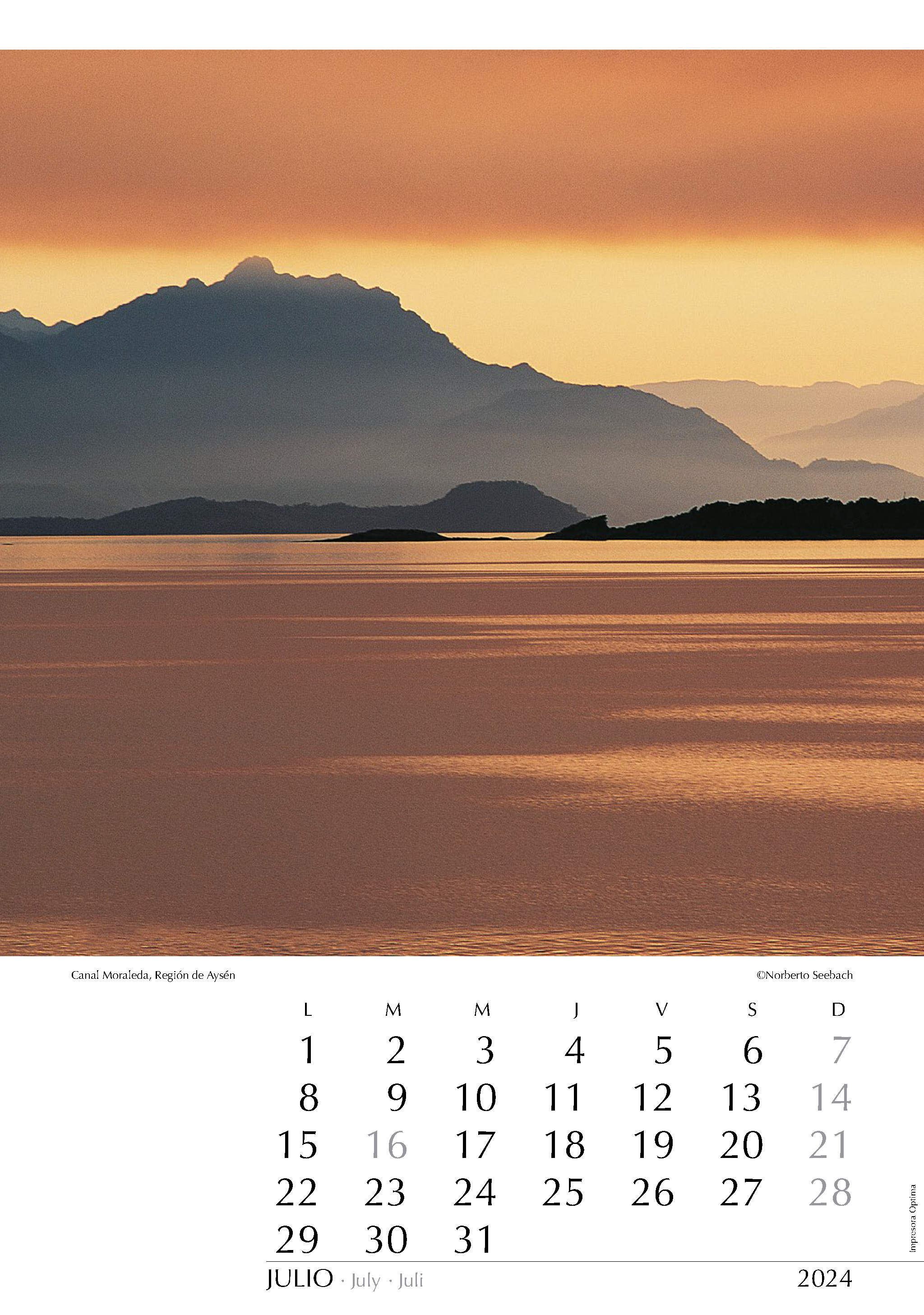
Canal Moraleda
Región de Aysén
Basta contemplar el mapa para reconocer que al sur de Puerto Montt la geografía se desordena tremendamente. La zona de los canales patagónicos se extiende por más de 5 grados latitudinales, incluyendo una maraña de unas 6000 islas. En dirección sur y tras dejar atrás la isla de Chiloé y el golfo Corcovado se ingresa al canal Moraleda, una amplia vía marítima de unos 130 km de extensión que separa las islas Guaitecas y el archipiélago de los Chonos, de la costa continental.
Just by looking at the map, it is evident that south of Puerto Montt, the geography becomes incredibly disordered. The region of the Patagonian channels extends for over 5 degrees of latitude, encompassing a tangle of approximately 6000 islands. Heading south and leaving behind Chiloé Island and the Corcovado Gulf, one enters the Moraleda Channel, a wide maritime route stretching for about 130 km. It separates the Guaitecas Islands and the Chonos Archipelago from the continental coast.
Ein Blick auf die Karte genügt, um zu erkennen, dass die Geografie südlich von Puerto Montt chaotisch wird. Die Region der patagonischen Kanäle erstreckt sich über mehr als 5 Breitengrade und umfasst ein Gewirr von ungefähr 6000 Inseln. Vom Norden kommend und nachdem man die Insel Chiloé sowie den Corcovado-Golf hinter sich lässt, gelangt man in den Moraleda-Kanal, eine breite Meeresroute, die sich über etwa 130 km erstreckt. Er trennt die Guaitecas-Inseln und den Chonos-Archipel von der Festlandsküste.
AGOSTO
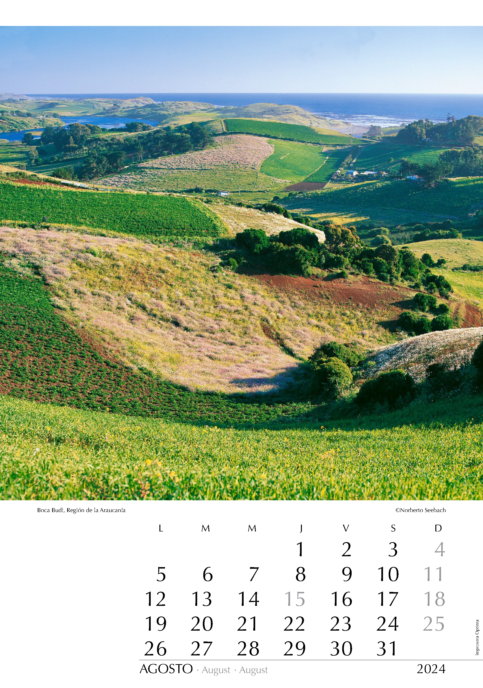
Boca Budi
Región de la Araucanía
Al poniente de la ciudad de Temuco, entre las cuencas de los ríos Imperial y Toltén, se encuentra el lago Budi rodeado por los suaves lomajes de la Cordillera de la Costa que en este sector no alcanza gran altura. Sus aguas salobres y poco profundas (menos de 15 m) cubren unos 50 km2 de un enjambre de bahías, penínsulas e islas y se conectan con el mar a través del río cuya desembocadura se aprecia en la imagen. Estas tierras son pobladas mayoritariamente por mapuche, que viven de la agricultura y de la pesca.
To the west of the city of Temuco, between the basins of the Imperial and Toltén rivers, lies Lake Budi, surrounded by the gentle slopes of the Coastal Range, which in this area does not reach great heights. Its brackish and shallow waters (less than 15 m deep) cover an area of about 50 km2, forming a network of bays, peninsulas, and islands. It is connected to the sea through the river, whose mouth is visible in the image. These lands are predominantly inhabited by the Mapuche people, who live off agriculture and fishing.
Westlich der Stadt Temuco, zwischen den Flussbecken des Imperial und Toltén, liegt der Budi-See, umgeben von den sanften Hängen der Küstenkordillere, die in diesem Bereich keine großen Höhen erreicht. Sein salziges und flaches Wasser (weniger als 15 m tief) bedeckt eine Fläche von etwa 50 km2 und bildet ein Netzwerk aus Buchten, Halbinseln und Inseln. Er ist über den Fluss mit dem Meer verbunden, dessen Mündung auf dem Bild sichtbar ist. Diese Gebiete werden hauptsächlich von den Mapuche bevölkert, die von Landwirtschaft und Fischerei leben.
SEPTIEMBRE
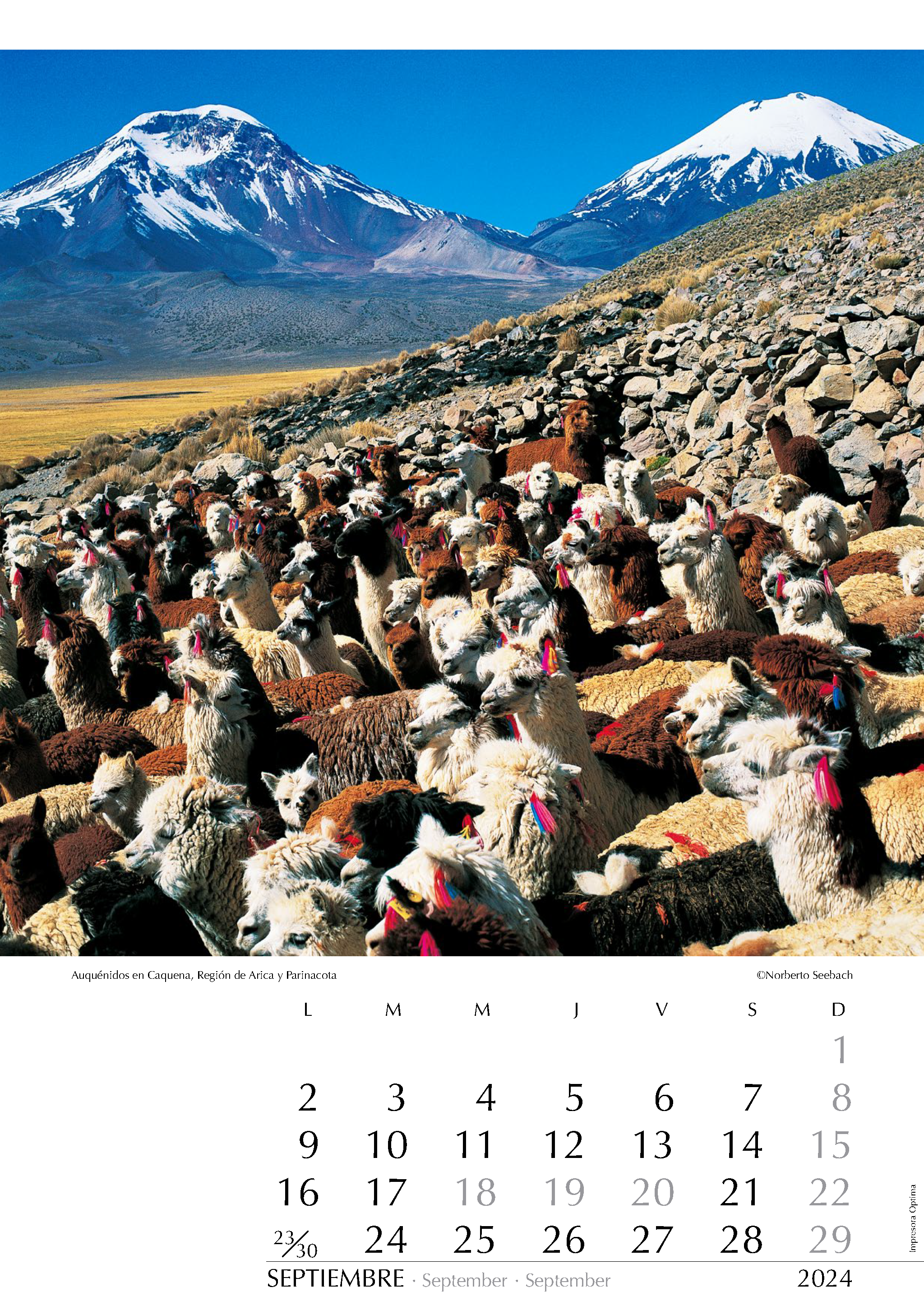
Auquénidos en Caquena
Región de Arica y Parinacota
A los pies de los Nevados de Payachata, hermosa e imponente pareja de volcanes (Pomerape 6280 m y Parinacota 6340 m) que domina el altiplano de Arica, se extiende el bofedal de Caquena. Los auquénidos que se nutren de él constituyen un importante sustento para los pobladores, generalmente aymaras que habitan en estas inhóspitas alturas. De los camélidos aquí acorralados, los habitantes utilizan su lana, carne, cuero y abono. Para decorar las llamas (Lama glama) y alpacas (Lama pacos) se usa lana teñida.
At the base of Nevados de Payachata, a beautiful and imposing pair of volcanoes (Pomerape 6280 m and Parinacota 6340 m) that dominate the Arica highlands, extends the Caquena wetland. The camelids that feed on it provide an important livelihood for the inhabitants, usually Aymara people who live in these inhospitable heights. From the animals fenced here, the locals use their wool, meat, leather, and manure. Multicolored dyed wool adorns the llamas (Lama glama) and alpacas (Lama pacos).
Am Fuße der Nevados de Payachata, des reizvollen Vulkanpaares (Pomerape 6280 m und Parinacota 6340 m), das über das Andenhochland bei Arica ragt, liegt das Hochmoor von Caquena. Die Lamas (Lama glama) und Alpakas (Lama pacos) die hier weiden sind für die Bewohner dieser unwirtlichen Höhen, vorwiegend Aymara, wichtigste Lebensgrundlage. Mit gefärbter Wolle werden sie geschmückt. Von den eingepferchten Tieren nutzen die Ureinwohner Wolle, Fleisch, Leder und Mist.
OCTUBRE
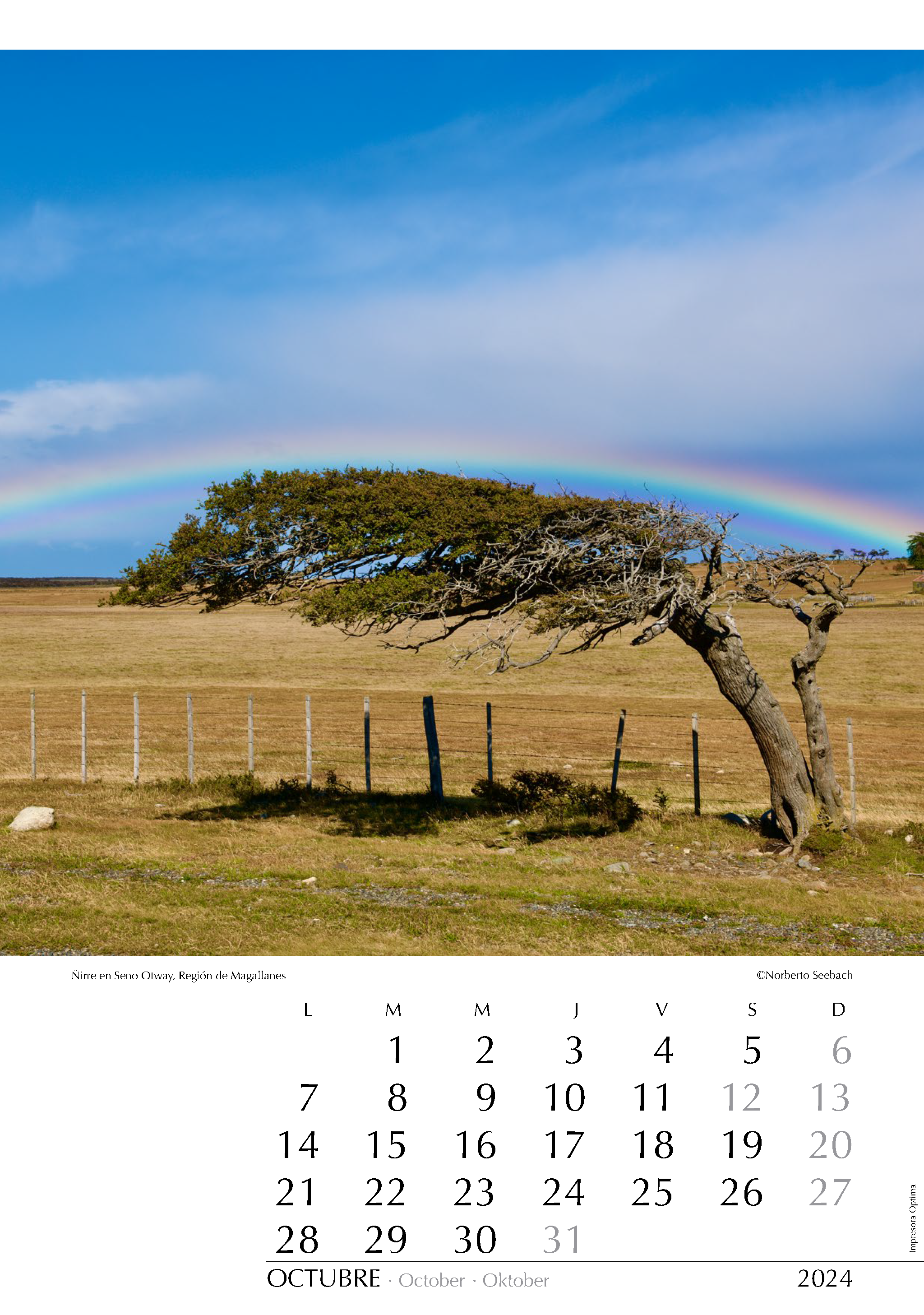
Ñirre en Seno Otway
Región de Magallanes
El Ñirre (Nothofagus antárctica) es un árbol nativo de los bosques subantárticos de América del Sur. Es una especie perenne que tiene una corteza gruesa y rugosa de color gris oscuro y sus hojas son pequeñas y de forma ovalada, con bordes dentados y color verde brillante en la cara superior y más pálidas en la parte inferior. Destaca por su adaptación a condiciones climáticas extremas y es frecuente verlos con retorcidas formas producto del viento. Este ñirre fue captado al borde de un camino al norte del Seno Otway en la Patagonia magallánica.
The Ñirre (Nothofagus antarctica) is a native tree of the subantarctic forests of South America. It is an evergreen species with a thick and rough dark gray bark, and its leaves are small and oval-shaped, with serrated edges. The upper side of the leaves has a bright green color, while the lower side is paler. The Ñirre stands out for its adaptation to extreme weather conditions, and it is common to see them with twisted forms caused by the wind. This Ñirre was captured at the edge of a road north of Seno Otway in the Magellanic Patagonia.
Der Ñirre (Nothofagus antarctica) ist ein heimischer Baum der subantarktischen Wälder Südamerikas. Es handelt sich um eine immergrüne Art mit einer dick und grob strukturierten, dunkelgrauen Rinde. Die Blätter sind klein und ovalförmig mit gesägten Rändern. Die Oberseite der Blätter ist leuchtend grün, während die Unterseite blasser ist. Der Ñirre zeichnet sich durch seine Anpassungsfähigkeit an extreme Wetterbedingungen aus. Häufig kann man beobachten, wie er durch den Wind in ungewöhnliche und verdrehte Gestalten gebracht wird. Dieser Ñirre wurde am Rand einer Straße nördlich von Seno Otway aufgenommen.
NOVIEMBRE
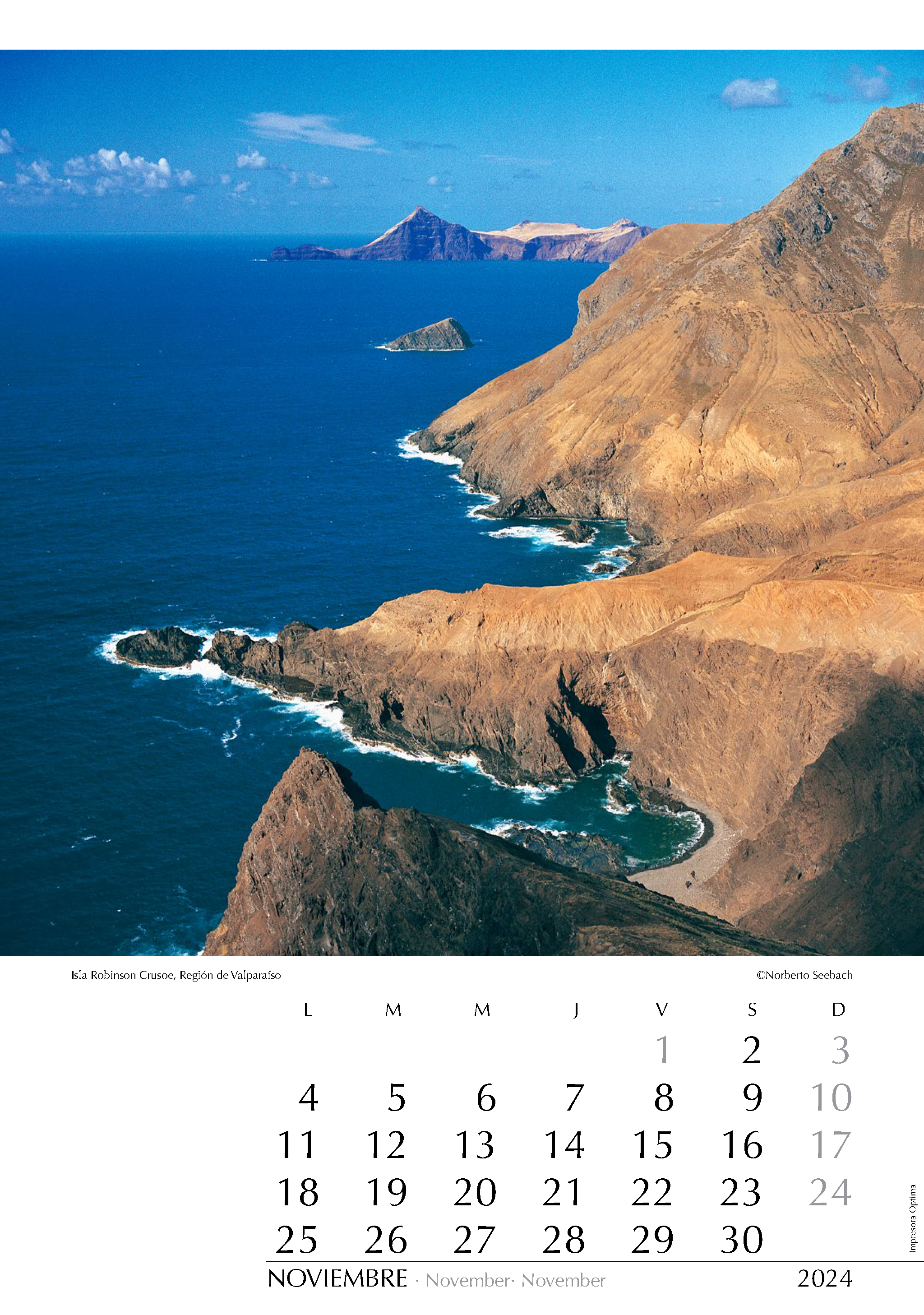
Isla Robinson Crusoe
Región de Valparaíso
Casi en la misma latitud del puerto de San Antonio y 600 km más al oeste, está la isla Robinson Crusoe. Junto a Alejandro Selkirk y Santa Clara, conforma el archipiélago Juan Fernández. Pocos lugares de Chile ofrecen una gama tan amplia de atractivos: origen volcánico con su loca topografía, exuberante vegetación con muchas especies endémicas en las zonas con alta pluviosidad, el contraste con la aridez de otros sectores, las cristalinas aguas de agradables temperaturas, y obviamente también sus cotizadas langostas. La costa de la isla es abrupta en prácticamente todo su contorno: desde la bahía Villagra se ve el extremo suroeste con la isla Santa Clara.
Located nearly at the same latitude as the port of San Antonio and 600 km further west, lies Robinson Crusoe Island. Alongside Alejandro Selkirk and Santa Clara, it forms the Juan Fernández Archipelago. Few places in Chile offer such a wide range of attractions: volcanic origin with its unique topography, lush vegetation with many endemic species in high rainfall areas, the contrast with the aridity of other sectors, the crystal-clear waters with pleasant temperatures, and of course, its highly prized lobsters. The island‘s coastline is steep along almost its entire perimeter: from Villagra Bay one can see the far southwest and Santa Clara Island.
Fast auf gleicher Breite wie San Antonio und 600 km weiter westlich liegt die Insel Robinson Crusoe. Zusammen mit Alejandro Selkirk und Santa Clara bildet sie den Juan-Fernández-Archipel. Nur wenige Orte in Chile bieten eine so reizvolle Vielfalt: Der vulkanische Ursprung mit einer verrückten Topografie, die üppige Vegetation mit zahlreichen endemischen Arten in den regenreichen Gebieten, der Kontrast zur Trockenheit anderer Regionen, das kristallklare Wasser mit angenehmen Temperaturen und die sehr begehrten Hummer. Die Küste der Insel ist nahezu entlang ihres gesamten Umfangs steil. Von der Villagra-Bucht aus blickt man auf das Eiland Santa Clara an der Südwestspitze.
DICIEMBRE
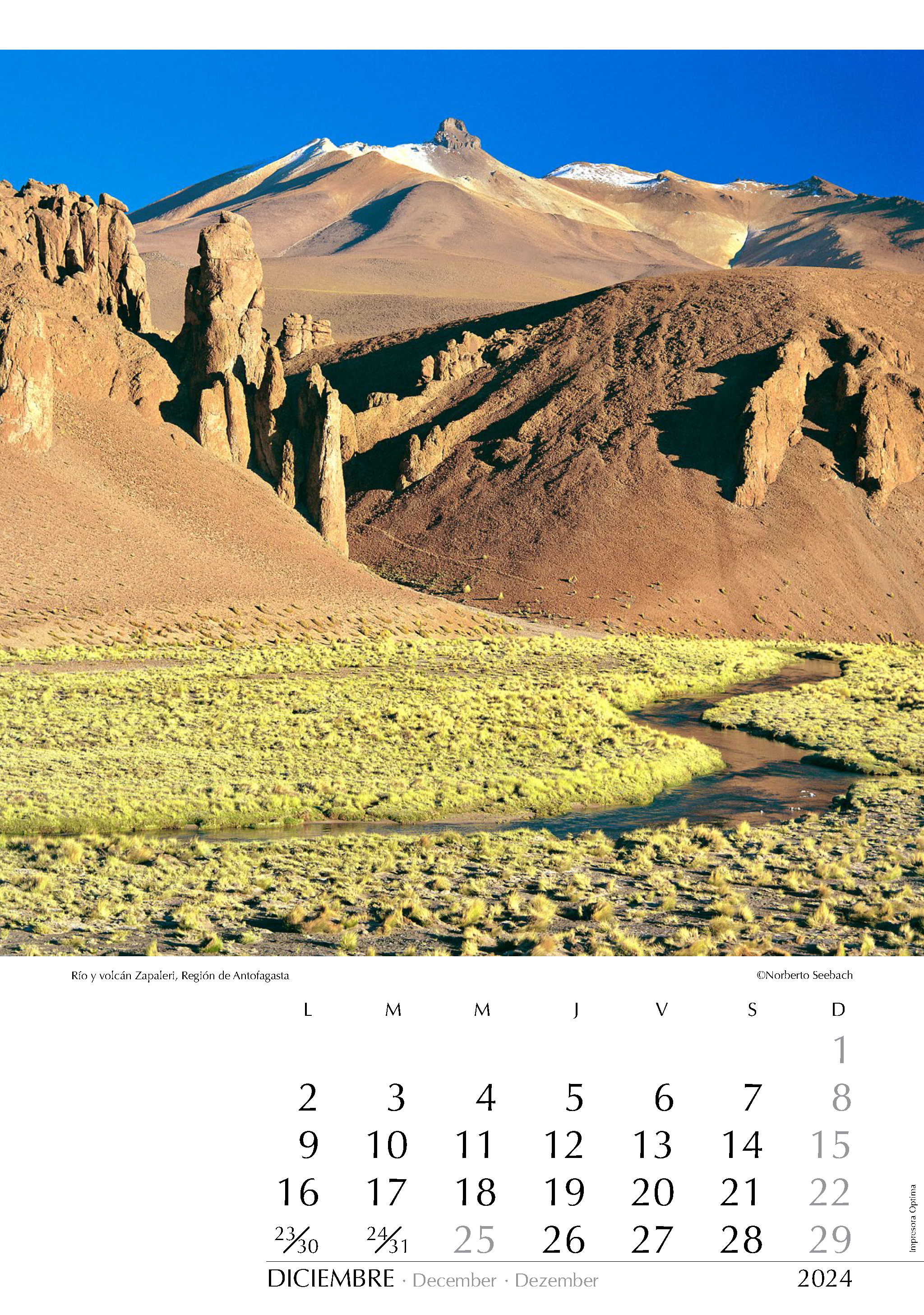
Río y volcán Zapaleri
Región de Antofagasta
En la Región de Antofagasta un poco al norte del Trópico dé Capricornio la larga y angosta faja de Chile Sudamericano, que en promedio no supera los 180 km, duplica dicha medida. En el extremo nororiente de este sector que se adentra al oriente, se yergue el volcán Zapaleri (5650 m), el cual constituye el límite tripartito de Argentina, Bolivia y Chile. El río homónimo que nace en Bolivia cruza territorio argentino y corre a más de 4000 m.s.n.m. a la laguna de Tara en Chile.
In the Antofagasta Region, a little north of the Tropic of Capricorn, the long and narrow strip of South American Chile, which on average does not exceed 180 km, doubles that measurement. At the northeastern end of this sector, which extends to the east, stands the Zapaleri volcano (5650 m), which constitutes the tripartite boundary between Argentina, Bolivia, and Chile. The homonymous river, originating in Bolivia, crosses Argentine territory and runs at an altitude of over 4000 meters above sea level to the Tara lagoon in Chile.
In der Region Antofagasta, knapp nördlich des Wendekreises, erreicht das langgezogene und schmale Chile das Doppelte seiner durchschnittlichen Breite von 180 km. Am nordöstlichen Ende dieses Sektors, der sich nach Osten erstreckt, erhebt sich der Zapaleri-Vulkan (5650 m), der die dreigeteilte Grenze zwischen Argentinien, Bolivien und Chile bildet. Der gleichnamige Fluss, der in Bolivien entspringt, durchquert argentinisches Gebiet und fließt auf einer Höhe von über 4000 Metern über dem Meeresspiegel zur Tara-Lagune in Chile.