Recorriendo Chile
Resumen del pedido
Calendario 2027
Volcán Tolhuaca
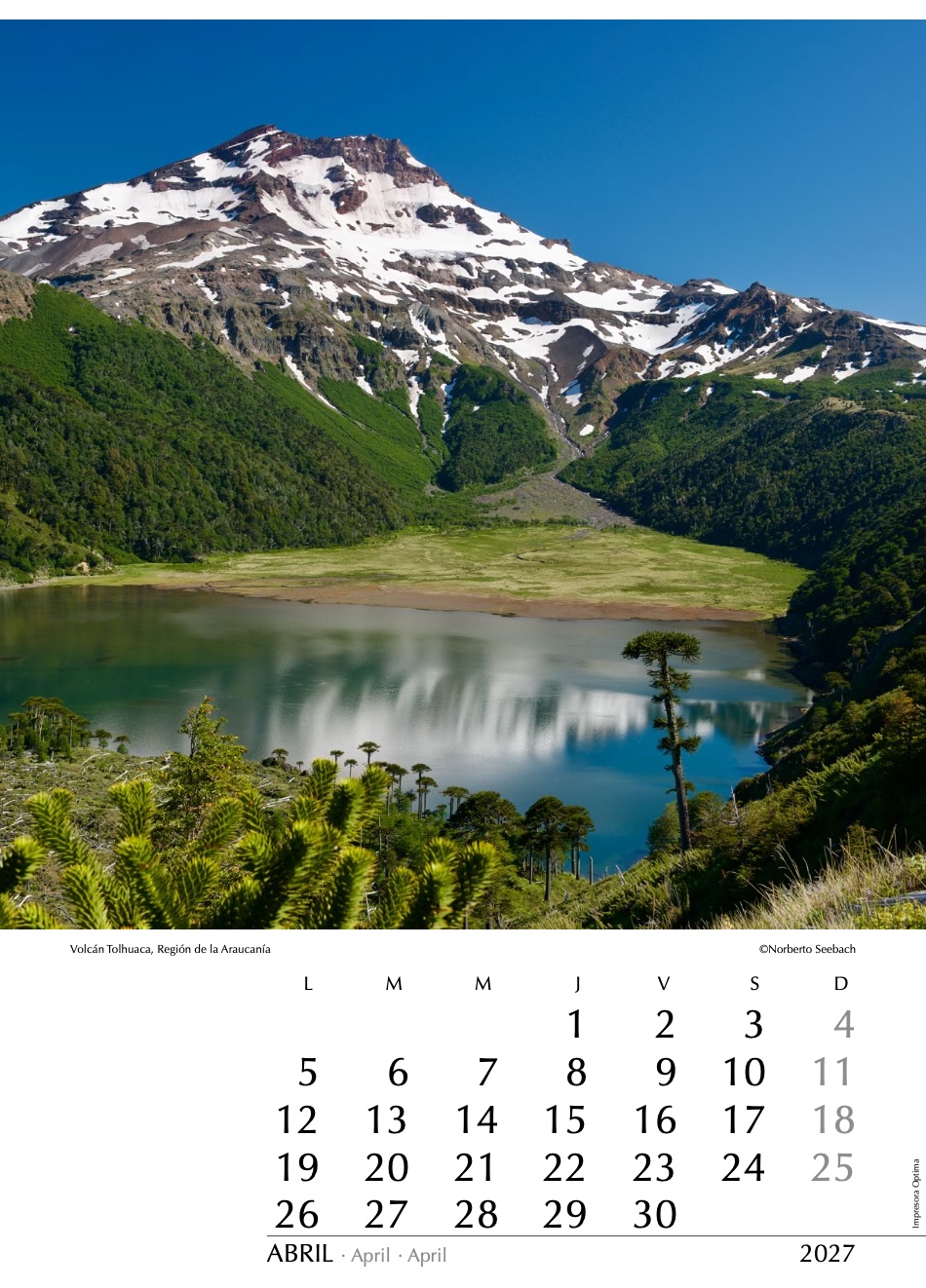
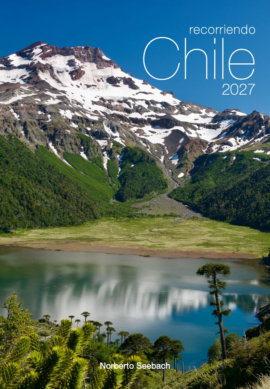
Una de las características más distintivas de la Región de La Araucanía son sus volcanes. El más septentrional de ellos es el volcán Tolhuaca (2800 m), ubicado en el límite entre las regiones del Biobío y La Araucanía. A espaldas del lugar desde donde fue captada esta fotografía, y a solo unos kilómetros más al sur, se encuentra el volcán Lonquimay (véase foto 10). También se observa aquí la laguna Blanca y, en las laderas que la rodean, milenarias araucarias, símbolo de las áreas protegidas de Chile.
One of the most distinctive features of the Araucanía Region is its volcanoes. The northernmost of them is Tolhuaca Volcano (2800 m), located on the boundary between the Biobío and Araucanía regions. Behind the location from which this photograph was taken, and just a few kilometers farther south, lies Lonquimay Volcano (see photo 10). Also visible here are Laguna Blanca and, on the slopes surrounding it, ancient monkey puzzle trees (Araucaria araucana), a symbol of Chile’s protected natural areas.
Zu den markantesten Merkmalen der Araucanía-Region zählen ihre Vulkane. Der nördlichste von ihnen ist der Vulkan Tolhuaca (2800 m), der an der Grenze zwischen den Regionen Biobío und La Araucanía liegt. Hinter dem Standort, von dem aus dieses Foto aufgenommen wurde, und nur wenige Kilometer weiter südlich befindet sich der Vulkan Lonquimay (siehe Foto 10). Zu sehen sind außerdem die Laguna Blanca sowie an ihren Hängen jahrtausendealte Araukarien (Araucaria araucana), das Symbol der geschützten Naturgebiete Chiles.
Camino a Jama
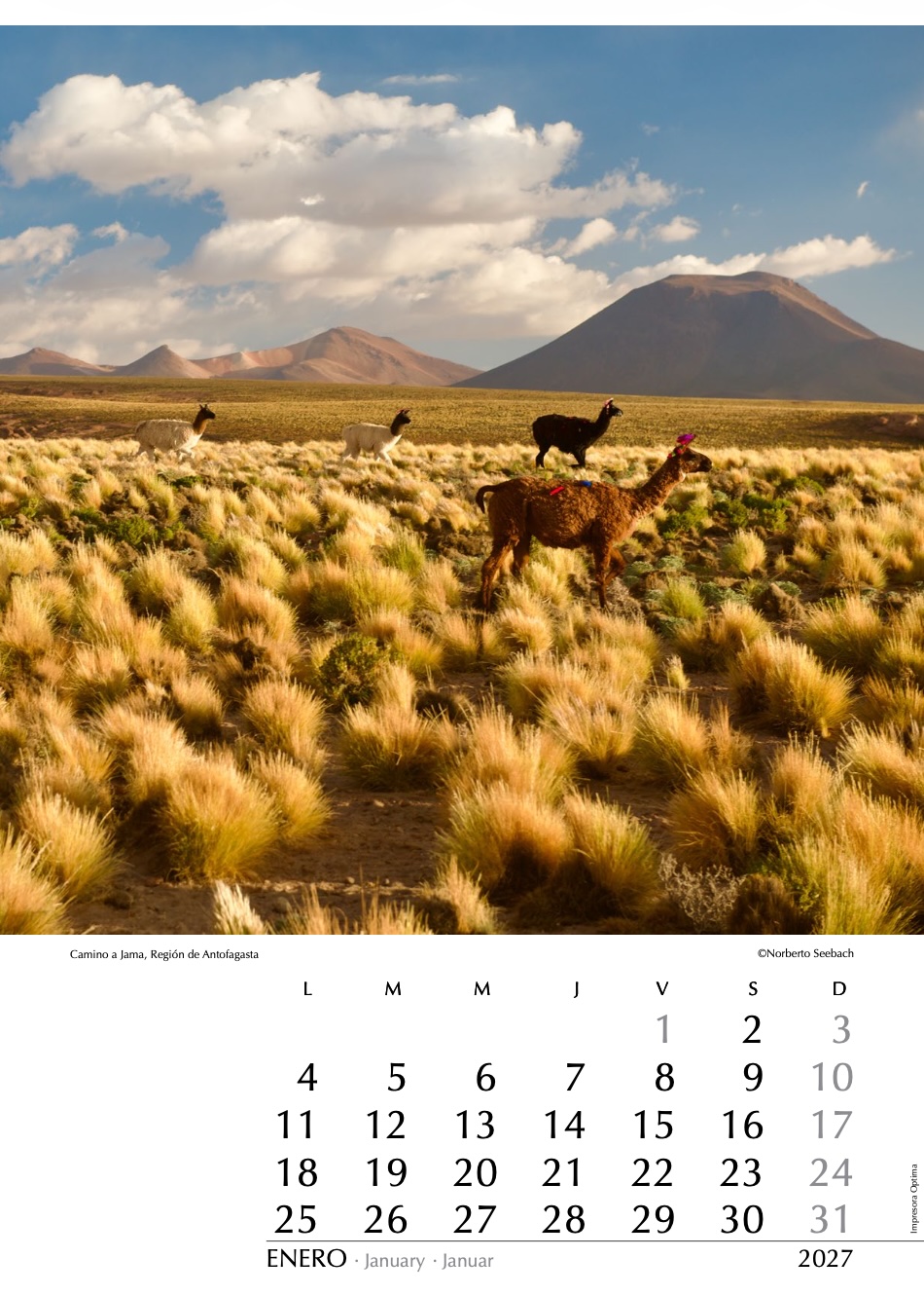
En el altiplano de Antofagasta, al avanzar desde San Pedro de Atacama (2400 m s. n. m.) hacia el oriente por la ruta a Argentina, en dirección al paso de Jama —y a Bolivia por el paso Hito Cajón—, el camino asciende de manera constante y, en tan solo 30 km, supera los 4000 m s. n. m. Es en este tramo donde, mirando hacia el sur, se observan estos ejemplares de llamas decoradas con tradicionales cintas coloridas para identificarlas. La fotografía, tomada al atardecer, resalta los tonos cálidos del paisaje altiplánico y el fuerte contraste entre la luz del desierto y el cielo andino.
In the Antofagasta Altiplano, as one travels east from San Pedro de Atacama (2400 m above sea level) along the road to Argentina toward the Jama Pass — and to Bolivia via the Hito Cajón Pass — the road climbs steadily and surpasses 4000 m above sea level after only 30 km. It is along this stretch of road that, looking southward, one can observe these llamas adorned with traditional colorful ribbons used to identify them. The photograph, taken at sunset, highlights the warm tones of the Altiplano landscape and the strong contrast between the desert light and the Andean sky.
Im Altiplano von Antofagasta steigt die Straße, wenn man von San Pedro de Atacama (2400 m ü. M.) ostwärts auf der Route nach Argentinien in Richtung des Jama-Passes — beziehungsweise nach Bolivien über den Hito-Cajón-Pass — fährt, stetig an und überschreitet bereits nach nur 30 km die Höhe von 4000 m ü. M. In diesem Abschnitt des Weges lassen sich beim Blick nach Süden diese Lamas beobachten, die mit traditionellen bunten Bändern geschmückt sind. Die bei Sonnenuntergang aufgenommene Fotografie betont die warmen Farbtöne der Altiplano-Landschaft und den Kontrast zwischen Wüstenlicht und Andenhimmel.
Bahía Hanusse
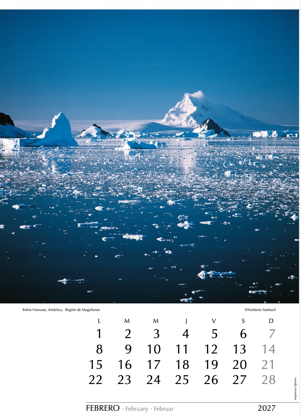
En algunos veranos es posible circunnavegar la gigantesca isla Adelaida, ubicada al sur del Círculo Polar Antártico. Tras alcanzar latitudes tan australes como la bahía Margarita, descubierta por Jean-Baptiste Charcot durante su expedición de 1910, se puede internar por el canal Barlas hasta llegar a la bahía Hanusse. Esta se encuentra cubierta de descomunales témpanos que los buques deben esquivar con cautela. Se trata de un lugar remoto y poco frecuentado por el creciente número de cruceros que visitan otras zonas del continente helado. El asentamiento más cercano es la base Rothera del Reino Unido, construida en la isla antes mencionada.
In some summers it is possible to circumnavigate the gigantic Adelaide Island, located south of the Antarctic Circle. After reaching latitudes as far south as Marguerite Bay, discovered by Jean-Baptiste Charcot during his 1910 expedition, it is possible to enter through the Barlas Channel and reach Hanusse Bay. This area is covered with enormous icebergs that ships must avoid with caution. It is a remote and rarely visited place. The nearest settlement is the British Rothera Station, built on the previously mentioned island.
In manchen Sommern ist es möglich, die riesige Adelaide-Insel südlich des Antarktischen Polarkreises zu umrunden. Nachdem man so südliche Breiten wie die Marguerite Bucht erreicht hat, die Jean-Baptiste Charcot während seiner Expedition von 1910 entdeckte, kann man durch den Barlas-Kanal bis zur Hanusse Bay vordringen. Diese ist von gewaltigen Eisbergen bedeckt, denen die Schiffe vorsichtig ausweichen müssen. Es handelt sich um einen abgelegenen und selten besuchten Ort. Die nächstgelegene Siedlung ist die britische Rothera-Station auf der zuvor erwähnten Insel.
Topocalma
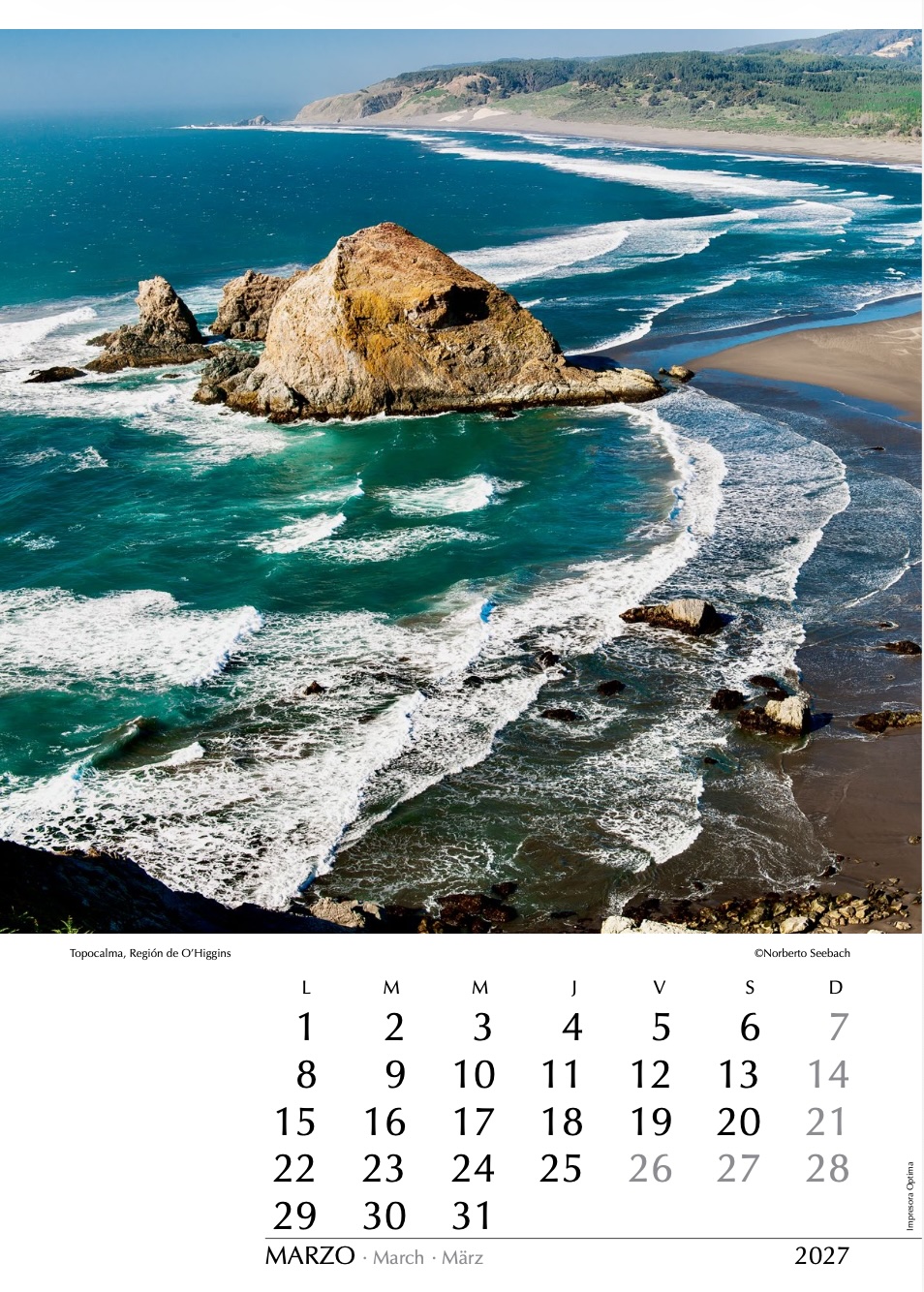
Un notable y hermoso accidente del litoral central es la punta Topocalma, ubicada a medio camino entre la desembocadura del río Rapel y el balneario de Pichilemu. Su acceso restringido ha contribuido a conservar el entorno natural de este lugar, cuyas laderas en primavera se cubren de flores, especialmente cactáceas. En la imagen se observa la roca que da nombre al Santuario de la Naturaleza Piedra del Viento y Topocalma, área protegida creada en 2021 para conservar este singular paisaje costero. Más al norte se encuentra Puertecillo. Cerca del morro desde el cual se captó esta vista, un faro orienta a los navíos.
A remarkable and beautiful feature of Chile’s central coast is Punta Topocalma, located midway between the mouth of the Rapel River and the seaside town of Pichilemu. Its restricted access has helped preserve the natural surroundings of this place, whose slopes in spring become covered with flowers, especially cacti. The image shows the rock that gives its name to the Piedra del Viento y Topocalma Nature Sanctuary, a protected area created in 2021. Farther north lies Puertecillo. Near the hill from which this photograph was taken, a lighthouse guides passing ships.
Ein markanter und schöner Abschnitt der Küste Zentralchiles ist Punta Topocalma, gelegen zwischen der Mündung des Rapel-Flusses und dem Badeort Pichilemu. Der eingeschränkte Zugang hat dazu beigetragen, die natürliche Umgebung dieses Ortes zu bewahren, dessen Hänge sich im Frühling mit Blumen, besonders Kakteen, bedecken. Auf dem Bild ist der Felsen zu sehen, der dem 2021 geschaffenen Naturschutzgebiet Piedra del Viento y Topocalma seinen Namen gibt. Weiter nördlich liegt Puertecillo. Nahe dem Hügel, von dem diese Aufnahme gemacht wurde, weist ein Leuchtturm den Schiffen den Weg.
Volcán Tolhuaca
Una de las características más distintivas de la Región de La Araucanía son sus volcanes. El más septentrional de ellos es el volcán Tolhuaca (2800 m), ubicado en el límite entre las regiones del Biobío y La Araucanía. A espaldas del lugar desde donde fue captada esta fotografía, y a solo unos kilómetros más al sur, se encuentra el volcán Lonquimay (véase foto 10). También se observa aquí la laguna Blanca y, en las laderas que la rodean, milenarias araucarias, símbolo de las áreas protegidas de Chile.
One of the most distinctive features of the Araucanía Region is its volcanoes. The northernmost of them is Tolhuaca Volcano (2800 m), located on the boundary between the Biobío and Araucanía regions. Behind the location from which this photograph was taken, and just a few kilometers farther south, lies Lonquimay Volcano (see photo 10). Also visible here are Laguna Blanca and, on the slopes surrounding it, ancient monkey puzzle trees (Araucaria araucana), a symbol of Chile’s protected natural areas.
Zu den markantesten Merkmalen der Araucanía-Region zählen ihre Vulkane. Der nördlichste von ihnen ist der Vulkan Tolhuaca (2800 m), der an der Grenze zwischen den Regionen Biobío und La Araucanía liegt. Hinter dem Standort, von dem aus dieses Foto aufgenommen wurde, und nur wenige Kilometer weiter südlich befindet sich der Vulkan Lonquimay (siehe Foto 10). Zu sehen sind außerdem die Laguna Blanca sowie an ihren Hängen jahrtausendealte Araukarien (Araucaria araucana), das Symbol der geschützten Naturgebiete Chiles.
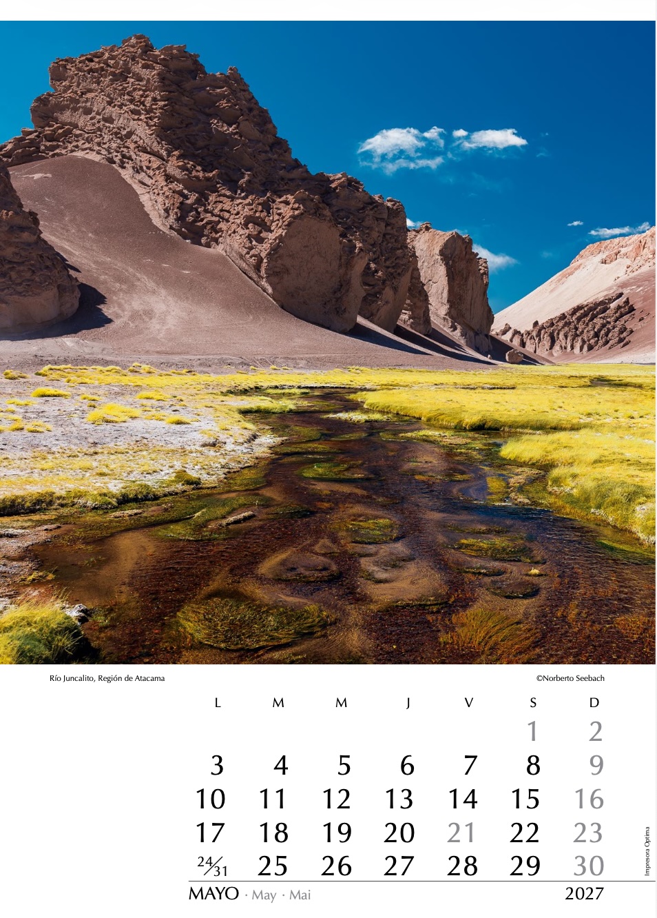
Río Juncalito
En una extensión de casi 700 km, ningún río alcanza la costa. La cordillera de Domeyko obstruye el paso de las vertientes que descienden desde el macizo andino, las que fluyen hacia alguno de los múltiples salares interiores. En algunos casos es el ser humano quien capta sus aguas casi en su lugar de origen. Serpenteando por un erosionado cañadón de la alta cordillera de Atacama, el río Juncalito corre a 4.200 m de altura hacia el norponiente. Parte de sus aguas son aprovechadas más abajo para abastecer las faenas mineras de Salvador y Potrerillos.
Along a stretch of nearly 700 km, no river reaches the coast. The Domeyko Range blocks the streams descending from the Andes massif, causing them to flow into one of the many inland salt flats. In some cases, humans capture their waters almost at their source. Winding through an eroded canyon in the high Andes of Atacama, the Juncalito River flows at 4.200 m above sea level toward the northwest. Part of its waters is used farther downstream to supply the mining operations of Salvador and Potrerillos.
Auf einer Strecke von fast 700 km erreicht kein Fluss die Küste. Die Cordillera Domeyko versperrt den Wasserläufen, die vom Andenmassiv herabfließen, den Weg, sodass sie in eines der zahlreichen inneren Salzbecken münden. In manchen Fällen nutzt der Mensch ihr Wasser bereits nahe der Quelle. Durch eine stark erodierte Schlucht der Hochanden von Atacama schlängelt sich der Río Juncalito auf 4.200 m Höhe nach Nordwesten. Ein Teil seines Wassers wird weiter flussabwärts für die Bergwerke Salvador und Potrerillos genutzt.
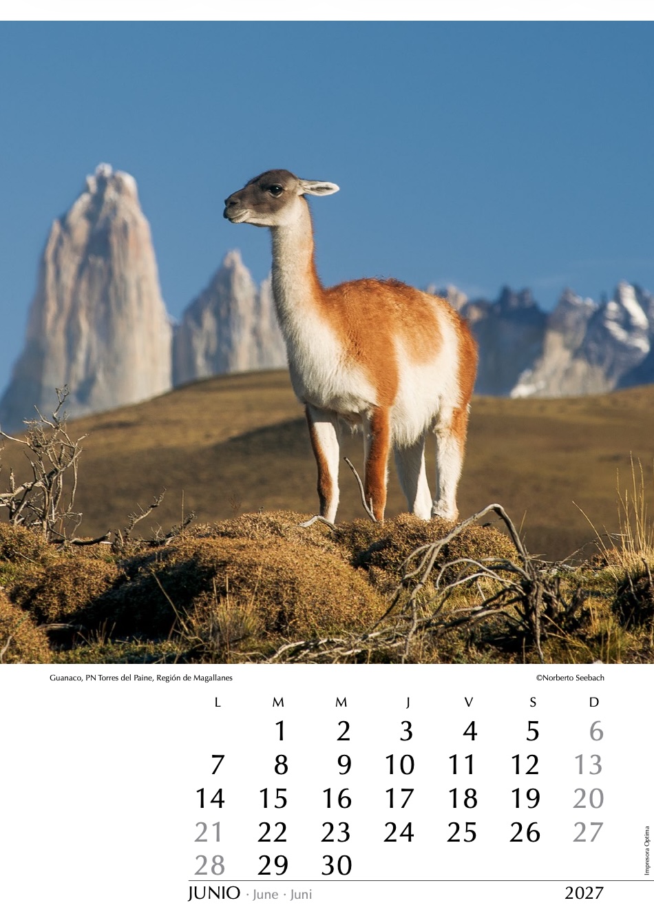
Guanaco, PN Torres del Paine
Posando orgullosamente, un guanaco observa con curiosidad al fotógrafo que intenta retratarlo. El telón de fondo lo constituyen las moles graníticas de las Torres del Paine, en el parque nacional homónimo. El camélido que se muestra (Lama guanicoe) está presente en gran parte del territorio nacional, desde el Altiplano hasta Tierra del Fuego. Los guanacos son particularmente abundantes en parajes protegidos como este, donde además parecen sentirse muy a gusto.
Proudly posing, a guanaco watches the photographer with curiosity as he attempts to capture it on camera. In the background rise the granite masses of the Torres del Paine in the national park of the same name. The camelid shown here (Lama guanicoe) is found throughout much of Chile, from the Altiplano to Tierra del Fuego. Guanacos are particularly abundant in protected areas such as this one, where they also seem to feel very much at ease.
Stolz posierend beobachtet ein Guanako neugierig den Fotografen, der versucht, es aufzunehmen. Im Hintergrund erheben sich die granitenen Türme der Torres del Paine im gleichnamigen Nationalpark. Das hier gezeigte Kamelid (Lama guanicoe) ist in großen Teilen Chiles verbreitet – vom Altiplano bis nach Feuerland. Guanakos sind besonders häufig in geschützten Landschaften wie dieser anzutreffen, wo sie sich offenbar sehr wohlfühlen.
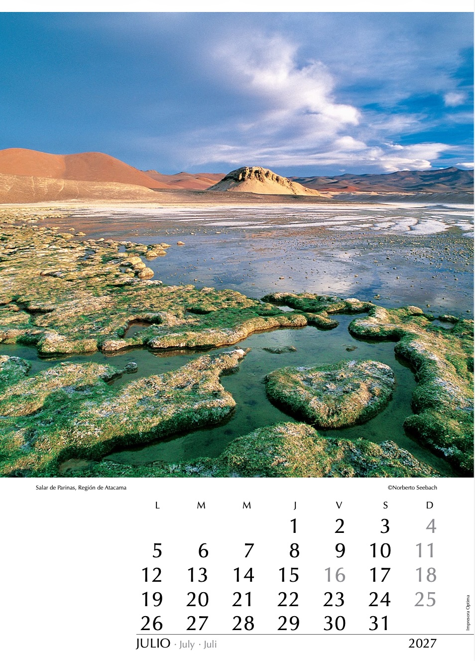
Salar de Parinas
La vastedad del desierto de Atacama presenta zonas cuya soledad y aislamiento impresionan. Por sobre los 4000 m de altitud, a unos 300 km al noreste de Copiapó y muy próximo a la frontera con Argentina, aventuradas huellas conducen hasta el salar de las Parinas, uno de los más recónditos salares enclavados en el macizo andino. Contrasta la aridez circundante con la riqueza de vida presente en sus aguas, sustento de aves como los flamencos —o parinas—, cuyo hábitat se encuentra cada vez más amenazado por el creciente interés minero sobre los salares altoandinos.
The vastness of the Atacama Desert includes areas whose solitude and isolation are striking. At over 4000 m in altitude, about 300 km northeast of Copiapó and very close to the Argentine border, adventurous tracks lead to the Salar de las Parinas, one of the most remote salt flats nestled within the Andes massif. The surrounding aridity contrasts with the richness of life sustained by its waters, habitat for birds such as flamingos — or parinas — whose environment is increasingly threatened by growing mining interest in the high Andean salt flats.
Die Weite der Atacama-Wüste birgt Gegenden von beeindruckender Einsamkeit und Verlassenheit. Auf über 4000 m ü.d.M., etwa 300 km nordöstlich von Copiapó und nahe der Grenze zu Argentinien führen abenteuerliche Spuren bis zum Salar de las Parinas einer der abgelegensten, der in der Andenkette eingebetteten Salzseen. Im Gegensatz zur leblosen Einöde der Umgebung enthält das Wasser Organismen welche den Vogelarten (darunter Flamingos auch Parinas genannt) als Nahrung dienen. Jene flüchten vor den stets wachsenden Aktivitäten der Minen, die diesen Ort allerdings noch nicht erreicht haben.
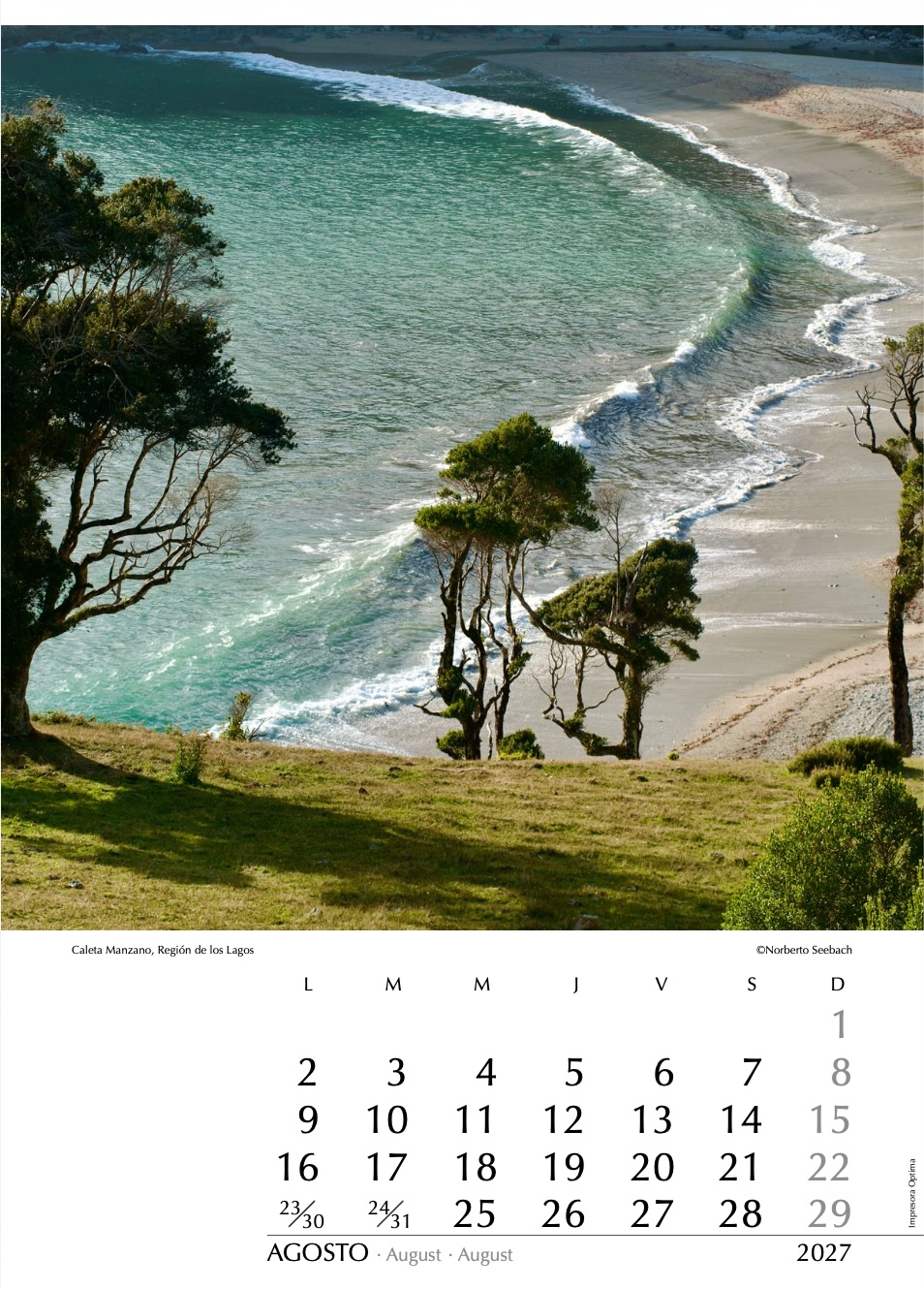
Caleta Manzano
Con varios miles de kilómetros de costa, Chile ofrece una variedad difícilmente superable de playas, a menudo solitarias. A unos 80 km al poniente de la ciudad de Osorno, y tras pasar por otras bahías como Contaco o Pucatrihue, continuando luego en dirección norte, se llega a la caleta Manzano. La ruta costera se interrumpe allí en diversos puntos: la cordillera de la Costa es abrupta y escarpada, con profundas quebradas, densamente cubierta por bosque valdiviano, además de numerosos esteros y ríos que históricamente han carecido de la infraestructura necesaria.
With several thousand kilometres of coastline, Chile offers a hardly surpassable variety of beaches, often solitary and untouched. About 80 km west of the city of Osorno, after passing through other bays such as Contaco and Pucatrihue and continuing northward, one reaches Caleta Manzano. The coastal route is interrupted there at various points: the Coastal Range is steep and rugged, with deep ravines densely covered by Valdivian rainforest, as well as numerous streams and rivers that historically have lacked the necessary infrastructure.
Mit mehreren tausend Kilometern Küstenlinie bietet Chile eine kaum zu übertreffende Vielfalt an Stränden, die oft einsam und unberührt sind. Etwa 80 km westlich der Stadt Osorno erreicht man — nachdem man andere Buchten wie Contaco oder Pucatrihue passiert hat und weiter nach Norden fährt — die Caleta Manzano. Dort wird die Küstenstraße an mehreren Stellen unterbrochen: Die Küstenkordillere ist steil und schroff, von tiefen Schluchten durchzogen und dicht mit valdivianischem Regenwald bedeckt; hinzu kommen zahlreiche Bäche und Flüsse, denen historisch die notwendige Infrastruktur fehlt.
Lago Jeinimeni
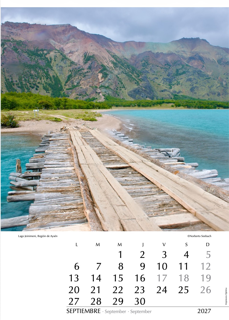
La mitad de los más de 100.000 km² de la extensa Región de Aysén corresponde a parques o reservas nacionales. Al suroeste de Chile Chico se encuentra el lago Jeinimeni, hoy parte del Parque Nacional Patagonia, que integra las antiguas reservas Tamango y Jeinimeni, además del valle Chacabuco, incorporado gracias al aporte de la fundación del fallecido filántropo y ambientalista Douglas Tompkins. El lugar incluye múltiples atractivos, entre ellos pinturas rupestres, zorros y flamencos. Destacan el color turquesa de las aguas y las variadas tonalidades de las serranías y la estepa.
Half of the more than 100,000 km² that make up the vast Aysén Region are protected as national parks or reserves. Southwest of Chile Chico lies Lake Jeinimeni, now part of Patagonia National Park, which incorporates the former Tamango and Jeinimeni reserves, together with the Chacabuco Valley, added through the contribution of the foundation established by the late philanthropist and environmentalist Douglas Tompkins. The area includes multiple attractions, among them rock art, foxes and flamingos. Particularly striking are the turquoise colour of the waters and the varied tones of the surrounding hills and steppe.
Die Hälfte der mehr als 100.000 km² großen Region Aysén steht als Nationalpark oder Naturschutzgebiet unter Schutz. Südwestlich von Chile Chico liegt der Lago Jeinimeni, heute Teil des Nationalparks Patagonia, der die ehemaligen Schutzgebiete Tamango und Jeinimeni sowie das Valle Chacabuco umfasst, das durch die Stiftung des verstorbenen Philanthropen und Umweltschützers Douglas Tompkins eingebracht wurde. Die Gegend bietet zahlreiche Sehenswürdigkeiten, darunter Felsmalereien, Füchse und Flamingos. Besonders charakteristisch sind das türkisfarbene Wasser sowie die vielfältigen Farbtöne der Bergzüge und der Steppe.
Volcán Lonquimay
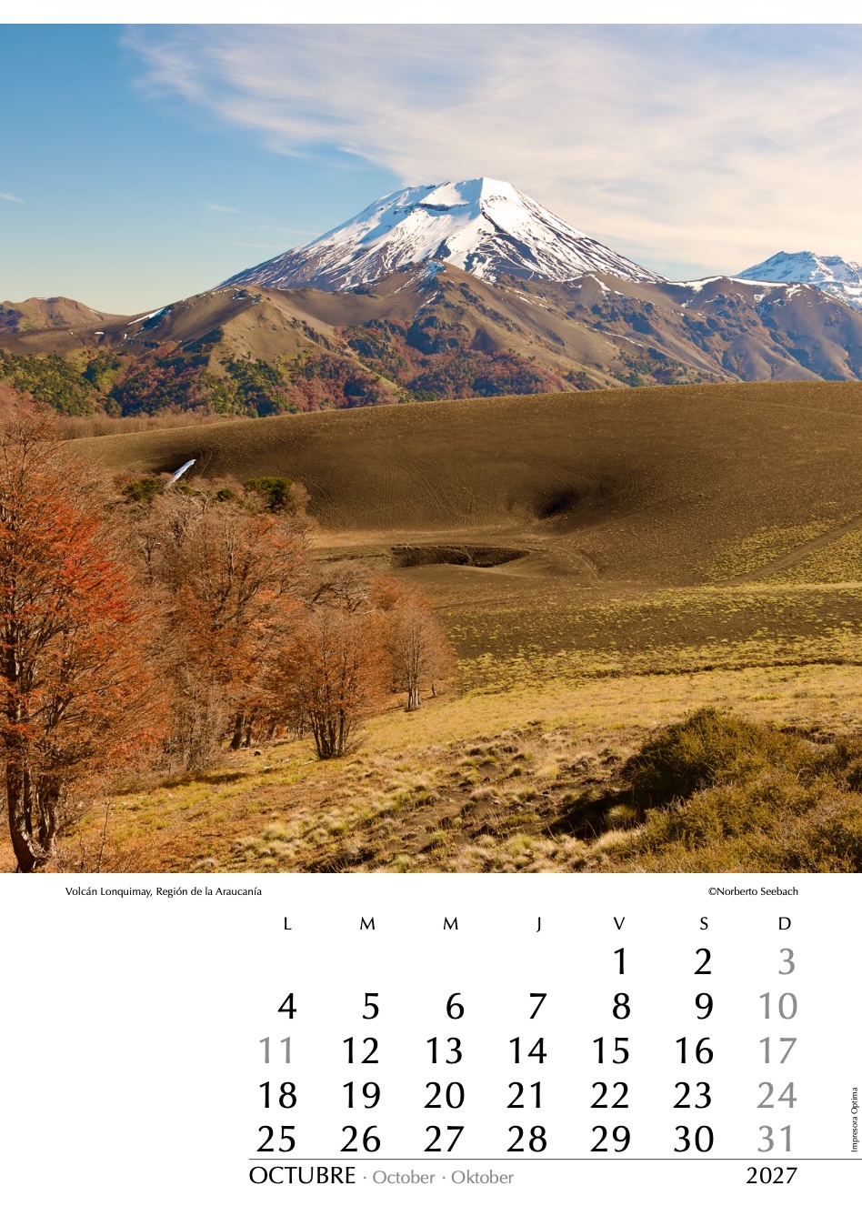
Desde las alturas de la Cordillera de las Raíces —un cordón montañoso que dificulta el acceso a la localidad de Lonquimay y sus alrededores en el Alto Biobío—, se observan hacia el norponiente las cumbres de los volcanes Lonquimay (2850 m) y Tolhuaca (2800 m), al fondo. En estas tierras mapuche, que en parte integran la Reserva Nacional Malalcahuello, destacan los escoriales volcánicos, la coloración otoñal de los bosques y las araucarias que cubren las laderas andinas. En las últimas décadas, el sector se ha consolidado además como un destino turístico de creciente relevancia, particularmente en invierno.
From the heights of the Cordillera de las Raíces — a mountain range that makes access to the town of Lonquimay and its surroundings in Alto Biobío difficult — the volcanic summits of Lonquimay (2850 m) and Tolhuaca (2800 m), in the background, can be seen to the northwest. In these Mapuche lands, which partly form part of Malalcahuello National Reserve, volcanic lava fields, the autumn colours of the forests, and the araucaria trees covering the Andean slopes stand out. In recent decades, the area has also established itself as a tourist destination of growing importance, particularly during the winter season.
Von den Höhen der Cordillera de las Raíces — eines Gebirgszuges, der den Zugang nach Lonquimay und seiner Umgebung im Alto Biobío erschwert — sind im Nordwesten die Vulkangipfel Lonquimay (2850 m) und Tolhuaca (2800 m), im Hintergrund, zu sehen. In diesem teilweise zur Reserva Nacional Malalcahuello gehörenden Mapuche-Gebiet prägen vulkanische Lavafelder, herbstlich gefärbte Wälder und Araukarien die Andenhänge. In den vergangenen Jahrzehnten hat sich die Region zudem zu einem touristisch zunehmend bedeutenden Reiseziel entwickelt, besonders im Winter.
Lago Bayo
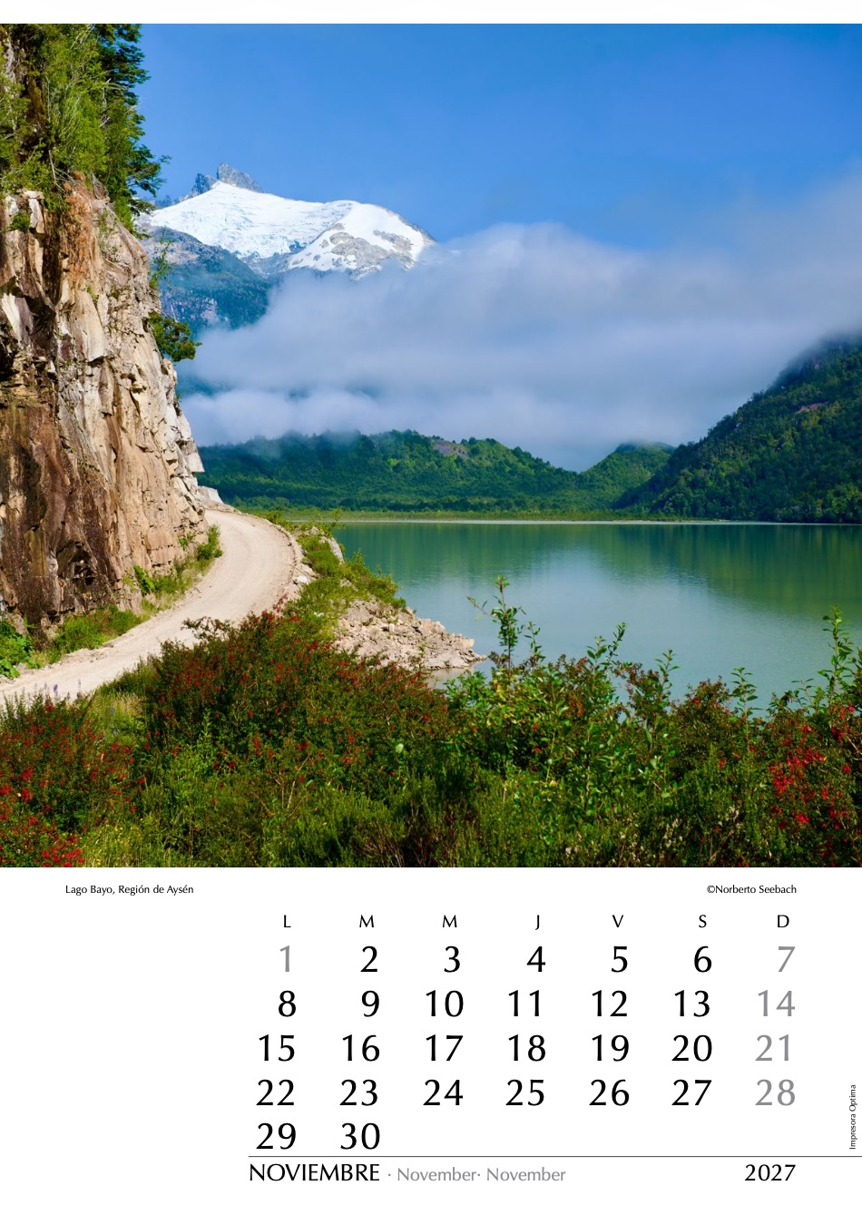
Un ambicioso proyecto impulsado por la dictadura militar fue la construcción de la Carretera Austral, cuyo objetivo era integrar Chiloé Continental y Aysén al resto de Chile. Aunque aún falta la conexión terrestre continua entre Puerto Montt y Chaitén, la ruta ha vertebrado la región y hoy existen múltiples caminos secundarios que facilitan el acceso a lugares remotos. Es el caso de la ruta que nace junto al lago General Carrera y que, por el valle Exploradores, a los pies del Campo de Hielo Norte, serpentea hacia el Pacífico bordeando aquí el lago Bayo.
An ambitious project promoted by the military dictatorship was the construction of the Carretera Austral, whose objective was to integrate Continental Chiloé and Aysén with the rest of Chile. Although a continuous land connection between Puerto Montt and Chaitén is still lacking, the route has become the backbone of the region, and today numerous secondary roads provide access to remote areas. This is the case of the road that begins near Lake General Carrera and, through the Exploradores Valley at the foot of the Northern Patagonian Ice Field, winds its way toward the Pacific, skirting here along Lake Bayo.
Ein ehrgeiziges Projekt der Militärdiktatur war der Bau der Carretera Austral, deren Ziel es war, Chiloé Continental und Aysén mit dem übrigen Chile zu verbinden. Obwohl bis heute eine durchgehende Landverbindung zwischen Puerto Montt und Chaitén fehlt, bildet die Straße das Rückgrat der Region, und zahlreiche Nebenstraßen ermöglichen inzwischen den Zugang zu abgelegenen Gebieten. Dazu gehört auch die Route, die nahe dem General-Carrera-See beginnt und sich durch das Exploradores-Tal am Fuß des Nördlichen Patagonischen Eisfeldes in Richtung Pazifik schlängelt, wobei sie hier am Lago Bayo entlangführt.
Volcán Guallatire
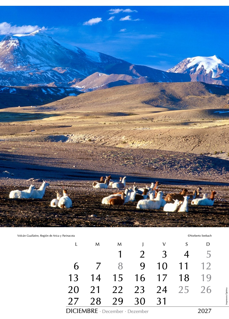
En el altiplano de la Región de Arica y Parinacota, a más de 4000 m s. n. m. y pocos kilómetros al sur de los volcanes Guallatire (6100 m) y Capurata (6000 m) —este al último al fondo y en la frontera con Bolivia—, un grupo de llamas descansa bajo la luz del atardecer. Destacan la aridez de la puna y las suaves ondulaciones del paisaje andino, dominado por extensos bofedales y cumbres volcánicas. En las cercanías se encuentra el poblado de Guallatire, conocido por el singular torreón blanco de su capilla altiplánica.
In the Altiplano of the Arica y Parinacota Region, at more than 4,000 m above sea level and a few kilometres south of the Guallatire Volcano (6,100 m) and Capurata Volcano (6,000 m) — the latter in the background and on the border with Bolivia — a group of llamas rests under the light of the setting sun. The aridity of the puna and the gentle undulations of the Andean landscape stand out, dominated by extensive bofedales wetlands and volcanic summits. Nearby lies the village of Guallatire, known for the distinctive white bell tower of its highland chapel.
Im Altiplano der Region Arica y Parinacota, auf über 4000 m Höhe und wenige Kilometer südlich der Vulkane Guallatire (6100 m) und Capurata (6000 m) — letzterer im Hintergrund und an der Grenze zu Bolivien — ruht eine Gruppe von Lamas im Licht der Abendsonne. Die Trockenheit der Puna und die sanften Formen der Andenlandschaft prägen die Szenerie, die von ausgedehnten Bofedales-Feuchtgebieten und vulkanischen Gipfeln dominiert wird. In der Nähe liegt das Dorf Guallatire, bekannt für den markanten weißen Glockenturm seiner Hochlandkirche.